
Ocean currents shape climate by moving heat, moisture, salt and dissolved gases around the planet. Warm currents can raise nearby sea-surface temperatures and feed milder, wetter air, while cold currents can cool coasts, favor fog and strengthen coastal upwelling. Currents do not act alone: winds, geography, sea ice and the atmosphere determine how strongly ocean circulation is felt on land.
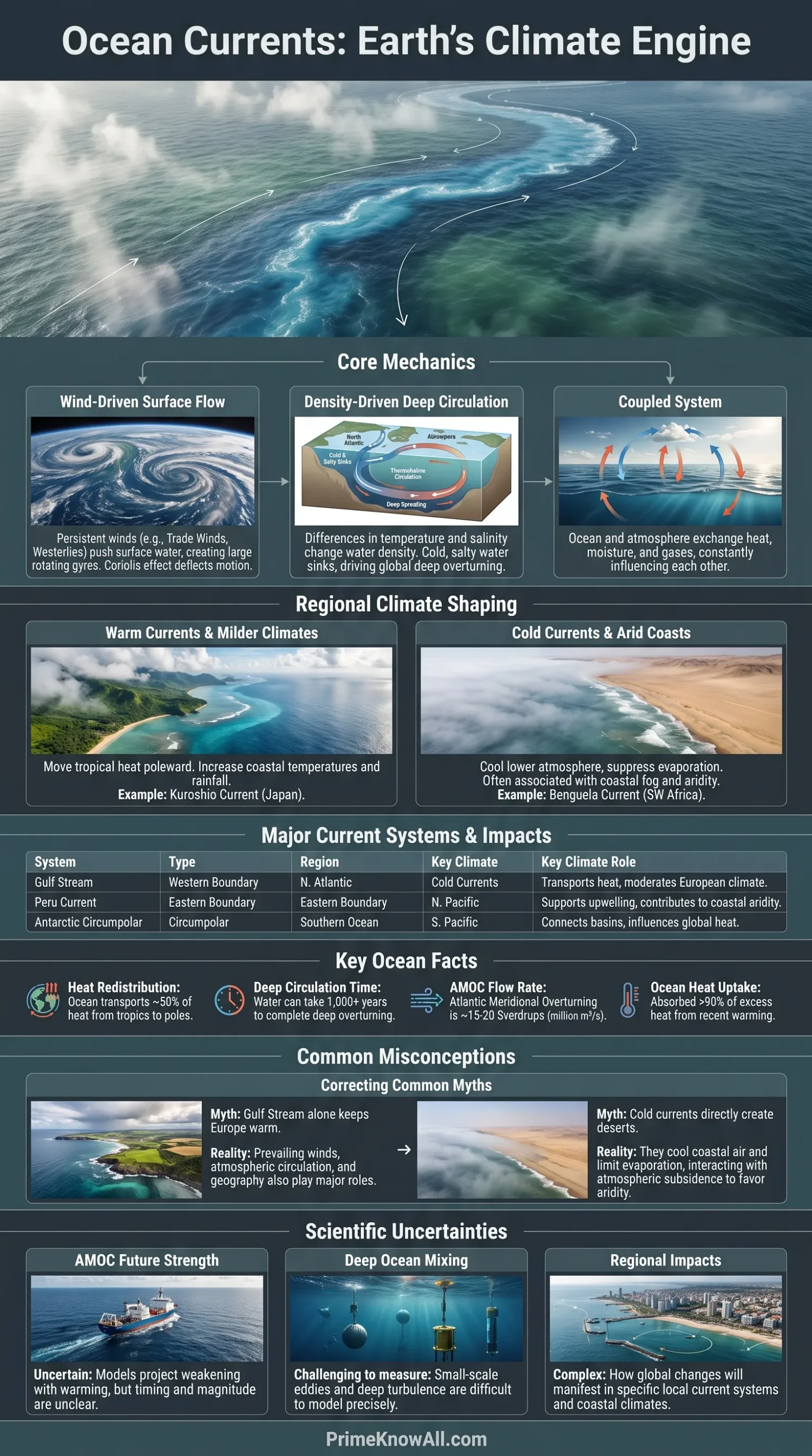
The effect reaches far beyond the shoreline. Ocean circulation redistributes solar energy from low latitudes toward colder regions, connects the surface ocean with deep water and helps determine where heat remains stored for months, decades or longer. That makes currents part of the machinery behind regional temperatures, rainfall patterns, marine ecosystems and long-term climate.
- Wind-driven currents dominate much of the upper ocean and form large rotating gyres.
- Temperature and salinity change seawater density, helping drive deep overturning circulation.
- Warm boundary currents move large amounts of tropical heat toward higher latitudes.
- Cold eastern-boundary currents can cool nearby coasts and support nutrient-rich upwelling.
- Ocean and atmosphere changes are coupled, so a shift in one can alter the other.
What Ocean Currents Are
An ocean current is a persistent movement of seawater through part of the ocean. Some currents flow mainly near the surface, while others involve water moving through the deep ocean. Their paths can stretch from a local coastline to entire ocean basins.
Currents differ from ordinary waves. A wave mainly transfers energy through water, although individual water particles may move in small paths. A current transports the water itself, carrying heat, salt, nutrients, oxygen and dissolved carbon with it.
Ocean circulation is also three-dimensional. Water can move north or south, east or west, but it can also sink, rise and mix vertically. Those vertical movements connect surface climate with the deep ocean.
What Makes Ocean Water Move
No single force controls every current. Wind, Earth’s rotation, gravity, density differences and the shape of ocean basins work together, with their relative influence changing from one region and depth to another.
Wind Pushes the Surface Ocean
Persistent winds transfer momentum to seawater through friction. The trade winds and mid-latitude westerlies, for example, help organize basin-scale circulation across the Atlantic, Pacific and Indian oceans.
The resulting water movement does not simply follow the wind. Earth’s rotation produces the Coriolis effect, which deflects large-scale motion to the right in the Northern Hemisphere and to the left in the Southern Hemisphere.
Gravity Responds to Sea-Surface Slopes
Wind can pile water slightly higher in one part of an ocean basin than another. Gravity pulls water away from these raised areas, while the Coriolis effect turns the flow. The balance between these forces helps maintain many broad geostrophic currents.
Temperature and Salinity Change Density
Cold seawater is generally denser than warm seawater. Higher salinity also raises density. Where surface water becomes cold and salty enough, it can sink and feed deep circulation. Scientists often describe circulation influenced by these density differences as thermohaline circulation, although real ocean overturning also depends heavily on winds and mixing.
Salinity matters as well as temperature. Cooling can make surface water denser, but freshwater from rain, rivers or melting ice can lower salinity and oppose sinking. The balance differs by region.
Surface Currents, Gyres and Boundary Currents
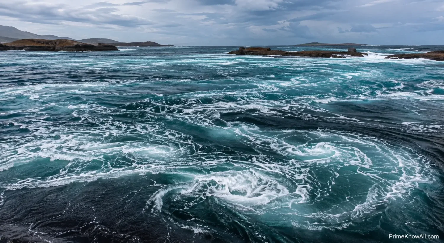
Most large ocean basins contain rotating systems called subtropical gyres. Winds and planetary rotation organize these flows, while continents force currents to turn rather than continue freely around the globe.
The North Atlantic and North Pacific subtropical gyres rotate mainly clockwise. Their counterparts in the South Atlantic, South Pacific and southern Indian Ocean rotate mainly counterclockwise. The currents on opposite sides of each gyre can have very different speeds and climate effects.
Western Boundary Currents
Currents such as the Gulf Stream, Kuroshio and Agulhas Current flow along the western edges of ocean basins. They tend to be narrow, deep and fast compared with currents on the opposite side of the same gyre. They move warm tropical or subtropical water toward higher latitudes and create sharp ocean temperature boundaries.
Eastern Boundary Currents
The California, Canary, Benguela and Peru or Humboldt currents occupy eastern sides of major ocean basins. They generally carry cooler water toward lower latitudes and are associated with several of the world’s major coastal upwelling regions.
| Current or System | Main Region | General Character | Climate Connection |
|---|---|---|---|
| Gulf Stream and North Atlantic Current | Western and northern Atlantic | Warm, poleward transport | Moves ocean heat toward the North Atlantic and affects air-sea heat exchange. |
| Kuroshio | Western North Pacific | Warm, fast western boundary current | Moves subtropical heat toward Japan and creates strong temperature contrasts offshore. |
| California Current | Western North America | Cool, equatorward current | Helps maintain cool coastal waters and supports seasonal upwelling. |
| Peru or Humboldt Current | Western South America | Cool, equatorward current | Supports upwelling and contributes to cool, dry conditions along parts of the Pacific coast. |
| Benguela Current | Southwestern Africa | Cool eastern-boundary current | Supports strong upwelling and cool coastal waters beside very dry land regions. |
| Agulhas Current | Southeastern Africa | Warm western boundary current | Carries warm, salty Indian Ocean water southward, with some water eventually entering the South Atlantic. |
| Antarctic Circumpolar Current | Southern Ocean | Eastward circumpolar flow | Connects the Atlantic, Pacific and Indian oceans and strongly influences Southern Ocean heat exchange. |
Deep Circulation and Density
Deep ocean circulation connects distant basins through sinking, spreading, mixing and eventual return toward the surface. Dense-water formation in high latitudes is one part of this process, especially around the North Atlantic and Antarctica.
In the North Atlantic, relatively warm and salty surface waters move northward. They lose heat to the atmosphere, and some become dense enough to contribute to deeper southward flow. This north-south overturning is part of the Atlantic Meridional Overturning Circulation, or AMOC.
Around Antarctica, very cold and sometimes salty waters can also descend into the deep ocean. Southern Ocean winds then help bring deep water back toward the surface elsewhere, linking deep circulation with the atmosphere again.
The familiar idea of a single global conveyor belt is useful for showing that the oceans are connected, but the real circulation is less orderly. Water follows many pathways, mixes between layers and may spend very different amounts of time at depth before resurfacing.
How Currents Move Heat Between Latitudes
The tropics receive more solar energy over the year than polar regions. The ocean and atmosphere redistribute part of that energy, reducing the temperature contrast that would exist if each latitude kept only the energy it received locally.
Warm currents transport heat stored in seawater toward higher latitudes. Once there, some heat passes from ocean to atmosphere through conduction, evaporation and infrared radiation. Winds can then carry that modified air far from the current itself.
Cold currents work differently. They can keep sea-surface temperatures below those of nearby land and reduce evaporation. Along some west coasts of continents, this favors cool marine air, low clouds and fog even where the surrounding latitude would otherwise suggest warmer conditions.
A useful analogy is a planet-sized heat distribution system. The tropics are regions where the ocean receives abundant energy, currents move part of that stored heat elsewhere, and the atmosphere exchanges energy with the moving water along the route. Unlike a household heating system, however, the ocean has no fixed pipes: its pathways shift with winds, density, seasons and climate.
How Currents Shape Rainfall, Fog and Storms
Currents influence the atmosphere mainly by changing sea-surface temperature and evaporation. Warm water can transfer more heat and water vapor into overlying air when atmospheric conditions allow it, while colder water tends to suppress evaporation and cool the lowest part of the atmosphere.
Warm Currents and Moisture
Warm western boundary currents create some of the strongest ocean-to-atmosphere heat exchanges outside the tropics. Temperature contrasts along the Gulf Stream and Kuroshio can influence cloud formation, rainfall zones and storm development over the North Atlantic and North Pacific.
Cold Currents and Coastal Fog
Where moist air passes over cold coastal water, the air near the surface can cool toward saturation. This helps explain frequent marine fog and low cloud along parts of California, southwestern Africa and western South America. Local winds and coastal topography still determine when fog actually forms.
Sharp Ocean Fronts and Storm Tracks
Where warm and cold waters meet, sea-surface temperature can change sharply over short distances. These ocean fronts alter the transfer of heat and moisture into the atmosphere and can help organize atmospheric temperature gradients associated with mid-latitude weather systems.
Upwelling, Marine Life and Coastal Climate
Upwelling occurs when deeper water rises toward the surface. Along many coasts, winds move surface water away from shore through Ekman transport, allowing colder subsurface water to replace it.
The rising water is often rich in nutrients that accumulated below the sunlit surface layer. Once those nutrients reach waters with enough sunlight, they can support phytoplankton growth and productive food webs. This is why upwelling zones off Peru, California, northwest Africa and southwest Africa support major marine ecosystems and fisheries.
Upwelling also changes climate near land. Colder surface water reduces the temperature of marine air and can limit evaporation. On some subtropical west coasts, cold currents and upwelling occur beside extremely dry landscapes, including areas near the Atacama and Namib deserts. The current is only part of the explanation; atmospheric subsidence, mountain barriers and regional wind patterns also matter.
A cold current does not automatically create a desert. Coastal dryness develops from several interacting processes, with ocean temperature helping reinforce conditions established by large-scale atmospheric circulation.
Ocean Currents and El Niño–Southern Oscillation
El Niño–Southern Oscillation, or ENSO, shows how tightly ocean circulation and the atmosphere can interact. ENSO is not one ocean current. It is a coupled pattern involving tropical Pacific sea-surface temperatures, winds, pressure and ocean circulation.
Under more typical tropical Pacific conditions, easterly trade winds help push warm surface water westward. Colder water rises more readily in the eastern equatorial Pacific, especially near the South American coast.
During El Niño, the trade winds weaken or change in ways that allow unusually warm surface water to spread farther east. Eastern Pacific upwelling is reduced or becomes less effective at cooling the surface. Tropical rainfall then shifts because the warmest water and strongest atmospheric convection are located differently.
During La Niña, stronger-than-usual trade winds commonly reinforce westward surface flow and cooler conditions across the central and eastern tropical Pacific. Those changes can alter rainfall and temperature patterns far outside the Pacific through atmospheric connections known as teleconnections.
How Ocean Circulation Stores Heat and Carbon
The ocean does more than move heat horizontally. Mixing and overturning transfer heat below the surface, where it can remain separated from the atmosphere for long periods. This large heat-storage capacity is one reason ocean measurements are central to understanding Earth’s energy balance.
NASA and other climate-observing agencies report that the ocean has absorbed more than 90% of the excess heat associated with the recent planetary energy imbalance. That heat is not spread evenly. Winds, eddies and major currents determine where much of it enters the ocean and where it is later transported.
Circulation also carries dissolved inorganic carbon and oxygen between the surface and deeper layers. Water that sinks after interacting with the atmosphere can carry dissolved substances away from the surface. When deep water later rises, it can return stored carbon and nutrients toward the upper ocean.
This means a change in circulation can alter not only regional temperature but also the location and duration of ocean heat and carbon storage.
How Current Systems Affect Real Places
Current maps become easier to understand when their effects are tied to recognizable coastlines. These examples show how ocean movement combines with winds and geography rather than acting as an isolated climate switch.
- Northwestern Europe: North Atlantic heat transport supplies relatively warm ocean water to high latitudes. Westerly winds can then carry maritime air over Europe, while atmospheric circulation and geography provide additional warming influences.
- Coastal California: The California Current and seasonal upwelling maintain cool coastal water. This helps explain why summer conditions near San Francisco can be much cooler and foggier than inland California at the same time.
- Peru and northern Chile: The Humboldt Current and coastal upwelling keep nearby Pacific waters cool. Combined with subtropical atmospheric circulation and the Andes, this contributes to the unusual dryness of the region.
- Japan: The warm Kuroshio meets colder waters associated with the Oyashio farther north. The resulting temperature contrasts support productive marine ecosystems and create strong ocean-atmosphere gradients.
- Namibia: Cold Benguela waters and upwelling cool the lower atmosphere along the coast. Fog can provide moisture even where rainfall over land is very low.
- Newfoundland and the northwestern Atlantic: Warm Gulf Stream waters lie relatively close to cold Labrador Current water. Strong temperature contrasts contribute to frequent marine fog in parts of the region.
- Southern Africa: The warm Agulhas Current runs rapidly along the southeastern coast before turning back into the Indian Ocean. Some warm, salty water escapes into the Atlantic through rings and eddies, linking circulation between ocean basins.
Ideas About Currents That Need More Precision
Several familiar descriptions of ocean circulation are useful starting points but become misleading when treated too literally.
- “The Gulf Stream keeps Europe warm.” North Atlantic ocean heat transport contributes to Europe’s maritime climate, but prevailing winds, atmospheric heat transport and geography also play major roles.
- “The Gulf Stream and the AMOC are the same thing.” They are related but not identical. The Gulf Stream is a western boundary current, while the AMOC describes a broader Atlantic overturning system with northward and southward flows at different depths.
- “The global conveyor belt is one continuous current.” Real deep circulation includes branching routes, turbulent mixing, eddies and several water masses rather than one closed belt.
- “El Niño is a warm current flowing toward South America.” ENSO involves interacting changes in winds, ocean temperatures, pressure, upwelling and equatorial circulation across much of the tropical Pacific.
- “Cold currents always make nearby land cold.” Their effect is strongest near coasts and depends on wind direction, season, topography and atmospheric circulation.
How Climate Change Can Alter Ocean Circulation
Ocean currents can change when winds, surface heating, rainfall, evaporation, sea ice or freshwater input change. These processes affect water density, vertical mixing and the pressure differences that help maintain circulation.
Warming of the upper ocean can strengthen stratification, meaning the surface and deeper layers become more resistant to mixing in some regions. Freshwater added at high latitudes can have a similar effect on density because fresher water is lighter than saltier water at the same temperature.
The AMOC receives particular scientific attention because it carries heat northward through the Atlantic and includes deep-water formation in high-latitude regions. Major climate assessments project that the AMOC is likely to weaken as the climate warms, although the size, timing and regional effects of that weakening remain uncertain.
A weaker AMOC would not mean that the entire Gulf Stream simply switches off. Wind-driven circulation would continue, while changes in the broader Atlantic system could alter sea level along some coasts, ocean heat distribution, rainfall patterns and regional temperatures.
What Scientists Still Cannot Predict Precisely
Ocean circulation is measured far better today than it was a few decades ago, but important uncertainties remain. The deep ocean is vast, direct records are short compared with many natural climate cycles, and small-scale eddies can affect how heat and salt move between larger current systems.
- Regional current changes: A basin-wide circulation trend does not tell scientists exactly how every local current or eddy will behave.
- Deep-ocean observations: Satellites observe the surface extremely well, but many deep processes still depend on floats, moorings, research vessels and indirect calculations.
- Freshwater effects: Changes in rainfall, river discharge, Greenland melt and Arctic freshwater can alter North Atlantic density, but their combined future influence varies among model simulations.
- Ocean eddies: Rotating features tens to hundreds of kilometers across move heat and salt across current boundaries and are difficult for lower-resolution climate models to represent directly.
- Timing: Ocean circulation contains natural variations ranging from seasons to decades, making the exact timing of long-term shifts harder to identify.
Observing systems reduce these uncertainties. Satellite measurements reveal changes in sea-surface temperature and height, moored instruments monitor important passages, and the international Argo program maintains thousands of autonomous profiling floats that repeatedly measure the upper and middle ocean.
How Ocean Motion Turns Into Climate
From Sunlight to Regional Climate
1. Tropical oceans gain heat
Low latitudes receive abundant solar energy, warming the surface ocean.
2. Winds organize surface flow
Trade winds and westerlies push seawater and help form large rotating gyres.
3. Earth’s rotation bends the motion
The Coriolis effect changes the direction of large-scale water movement.
4. Boundary currents redistribute heat
Fast warm currents carry tropical and subtropical water toward higher latitudes while cooler currents return water toward lower latitudes.
5. The ocean exchanges energy with the air
Warm or cold sea surfaces change evaporation, air temperature, clouds and nearby pressure patterns.
6. Sinking and upwelling connect different depths
Density changes, winds and mixing move water between the surface and deep ocean.
7. Climate responds across large distances
Heat and moisture carried by the ocean and atmosphere influence coastal temperatures, rainfall zones, marine ecosystems and some storm tracks.
The most useful way to think about ocean currents is as part of a connected ocean-atmosphere climate system. Currents redistribute energy and water properties, but the climate experienced at any location emerges from their interaction with winds, land, topography, latitude and seasonal sunlight.
Sources
- NOAA Ocean Service – Currents Tutorial explains the forces behind surface and deep ocean circulation. NOAA is the U.S. federal agency responsible for major ocean observation, research and forecasting programs.
- NOAA Ocean Service – What Is the Global Ocean Conveyor Belt? describes density-driven circulation and the connection between temperature, salinity and deep-ocean movement. The page is maintained by NOAA’s National Ocean Service.
- NASA Science – Ocean Warming provides measurements and context for ocean heat uptake and Earth’s energy imbalance. NASA combines satellite observations with other global climate measurements.
- IPCC – AR6 Working Group I Chapter 9: Ocean, Cryosphere and Sea Level Change assesses observed and projected changes in ocean circulation, including the AMOC. IPCC assessment chapters synthesize large bodies of peer-reviewed climate research.
- Science – What Is the Thermohaline Circulation? examines why the simple conveyor-belt description does not capture all processes driving large-scale ocean circulation. Science is a peer-reviewed research journal.
- Nature Geoscience – Current Atlantic Meridional Overturning Circulation Weakest in Last Millennium examines paleoclimate evidence related to long-term AMOC variability. Nature Geoscience publishes peer-reviewed Earth science research.
- Encyclopaedia Britannica – Ocean Current provides reference definitions and an overview of major current types and circulation processes. Britannica uses professionally edited reference material intended for general readers.
Questions About Ocean Currents and Climate
What causes ocean currents?
Ocean currents are driven by several processes, including wind, Earth’s rotation, gravity, temperature, salinity and differences in water density. Continents and seafloor topography then redirect the moving water.
How do warm ocean currents affect climate?
Warm currents transport heat toward cooler regions and can warm the air above them. When winds carry that maritime air over land, nearby regions may experience milder temperatures and greater moisture than they would without the ocean influence.
How do cold ocean currents affect climate?
Cold currents cool the air immediately above the ocean, reduce evaporation and can support coastal fog, low clouds and dry coastal conditions. Their exact effect depends on local winds and geography.
Is the Gulf Stream the same as the AMOC?
No. The Gulf Stream is a fast western boundary current in the North Atlantic. The AMOC is a much broader overturning system involving northward and southward water movement at different depths. The Gulf Stream forms part of the wider Atlantic circulation but is not identical to the AMOC.
Would Europe freeze if the Gulf Stream stopped?
No simple freezing scenario follows from changes in Atlantic circulation. Ocean heat transport contributes to Europe’s climate, but atmospheric circulation, prevailing winds, latitude and geography also influence European temperatures. A weaker AMOC could alter regional climate without meaning that the wind-driven Gulf Stream disappears entirely.
Is El Niño an ocean current?
No. El Niño is one phase of ENSO, a coupled ocean-atmosphere pattern in the tropical Pacific. It involves changes in trade winds, sea-surface temperatures, equatorial circulation, upwelling and tropical rainfall.
Can climate change alter ocean currents?
Yes. Warming, freshwater input, changing winds, rainfall, evaporation and sea-ice changes can alter water density, stratification and circulation. The response differs among current systems, and some future regional changes remain difficult to predict precisely.