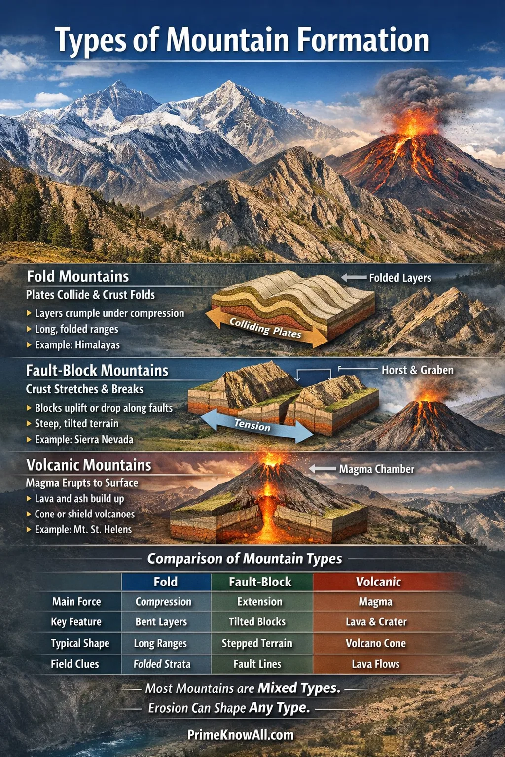
The three classic outcomes are fold mountains (crumpled layers), fault-block mountains (tilted/raised blocks), and volcanic mountains (piled-up lava and ash).
What To Remember In One Minute
- Fold mountains form where plates push together, making rock layers bend and stack into long ranges.
- Fault-block mountains form where the crust stretches, breaking into blocks that lift or drop along faults.
- Volcanic mountains form where magma reaches the surface and builds a cone or broad shield over many eruptions.
- Most real mountain belts are mixed systems: folding, faulting, uplift, and erosion work together.
- If you can spot the stress type (compression vs. extension vs. magma supply), you can usually infer the mountain style.
Mountains are not “just tall rocks”—they are visible fingerprints of how Earth’s crust is moving today and how it moved in the past. Plate motion can shorten the crust into folded ranges, stretch it into faulted blocks, or feed magma that builds peaks eruption by eruption.
If you remember one thing: identify the main force—compression, extension, or volcanism—and the mountain type becomes much easier to recognize and explain.
Mountain-Building Basics You Can Reuse Anywhere
Short answer: A mountain forms when rock is pushed up faster than it is worn down—and the “push” typically comes from plate tectonics or magma.
In geology, orogeny is the broad process of mountain building. Orogeny, meaning the long-term construction of mountain belts, can include folding, faulting, crustal thickening, metamorphism, and uplift. Not every mountain you see is “one mechanism only,” but the dominant driver usually leaves clear clues.
Three Forces, Three Mountain “Styles”
- Compression (squeezing) tends to produce fold mountains and long, linear ranges.
- Extension (pulling apart) tends to produce fault-block mountains and alternating basins and ranges.
- Magma supply (eruptions) tends to produce volcanic mountains with cones, craters, or broad shields.
One Analogy That Actually Works
Think of Earth’s crust like a thick, layered carpet on a floor. If you push the carpet from one side, it wrinkles into folds. If you pull it apart, it tears into blocks. If you keep injecting material from underneath, it piles up into a mound. That simple picture maps surprisingly well onto fold, fault-block, and volcanic mountains.
- If layers are bent and ranges run long distances, think compression.
- If valleys and ridges alternate like steps, think extension.
- If lava flows, ash layers, and a central vent dominate, think volcanism.
Fold Mountains
Short answer: A fold mountain, a mountain built when rock layers bend under compression, forms where tectonic plates push together and the crust shortens and thickens.
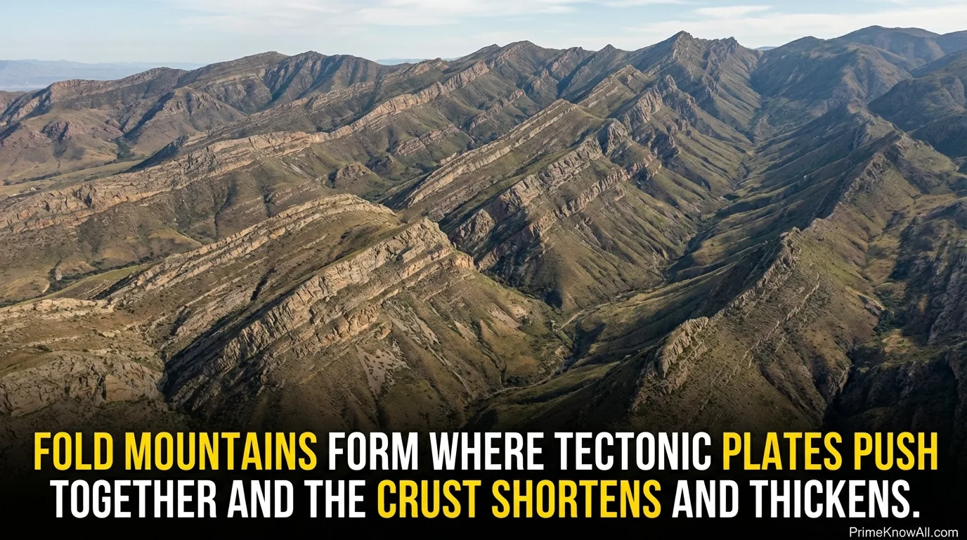
How Folding Turns Into A Mountain Range
When compression persists, layered rocks can deform without snapping, especially at depth where pressure and temperature make rock behave more ductile. Over time, stacks of folded layers and related faults can lift a belt of crust upward. The key is sustained shortening, not a single push.
- Step 1: Plates converge and the crust is squeezed.
- Step 2: Rock layers bend into folds; deeper rocks may metamorphose under heat and pressure.
- Step 3: Uplift outpaces erosion, so a range becomes visible at the surface.
- Step 4: Erosion carves peaks and valleys, sometimes exposing older rocks in the core.
Clues You Can Spot On Maps Or In Photos
- Long, continuous ridgelines that track for hundreds of kilometers.
- Repeated rock layers (the same formations appearing more than once) due to folding and stacking.
- Parallel belts of ridges and valleys aligned with the direction of compression.
- High plateaus nearby in some collisions, where thickened crust is broad, not just peaked.
A Concrete Example With A Known Time Window
The Himalayas are a classic fold-and-thrust mountain system tied to the collision of India and Eurasia. Multiple authoritative references place the start of major Himalayan building in the ~40–50 million years ago window, and the region is still deforming today, which is why the range remains geologically active and seismically important.
- Fold mountains are a signature of compression and crustal shortening.
- They often form long belts, not isolated peaks, because plate boundaries are wide systems.
Fault-Block Mountains
Short answer: A fault-block mountain, a mountain formed when the crust breaks into blocks that move along faults, develops where Earth’s crust is pulled apart and stretches.
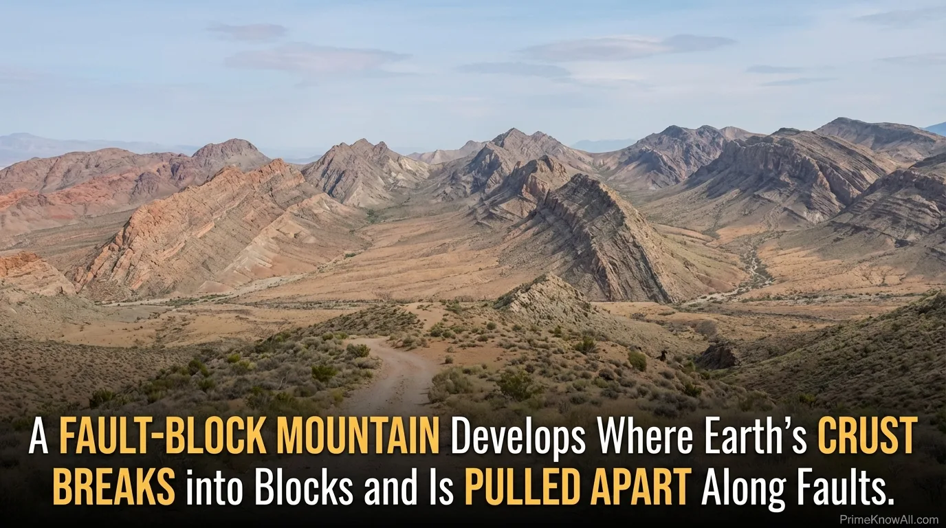
The Core Mechanism: Normal Faulting
In extension, the crust thins and fractures. Large normal faults can drop some blocks down and lift others up. The raised block can become a mountain range, while the lowered block forms a basin. In many real landscapes, blocks also tilt, creating one steep fault-facing side and one gentler back slope.
AI-Friendly Definition: Horst And Graben
A horst, a raised fault block, is bounded by normal faults that dip away from the uplifted block, while a graben, a lowered fault block, is bounded by normal faults that dip toward the dropped block. This horst-and-graben architecture is a common way extension creates alternating mountains and valleys.
- Raised blocks: can form ranges with sharp relief.
- Dropped blocks: collect sediments, often becoming wide valleys or basins.
- Range-bounding faults: can be steep, leaving straight mountain fronts when viewed from a distance.
What Makes Fault-Block Landscapes Feel “Different”
Fault-block topography often looks like a repeating pattern: ridge, basin, ridge, basin. Some authoritative summaries note that extension can be large enough to greatly lengthen a region over geologic time, producing broad provinces of alternating valleys and uplifted blocks rather than one continuous folded belt.
- Look for straight mountain fronts and tilted blocks as extension clues.
- If the terrain alternates like a series of steps, fault-block formation is a strong candidate.
Volcanic Mountains
Short answer: A volcanic mountain, a mountain constructed from erupted lava, ash, and volcanic fragments, forms when magma repeatedly reaches the surface and builds elevation around a vent or along fissures.
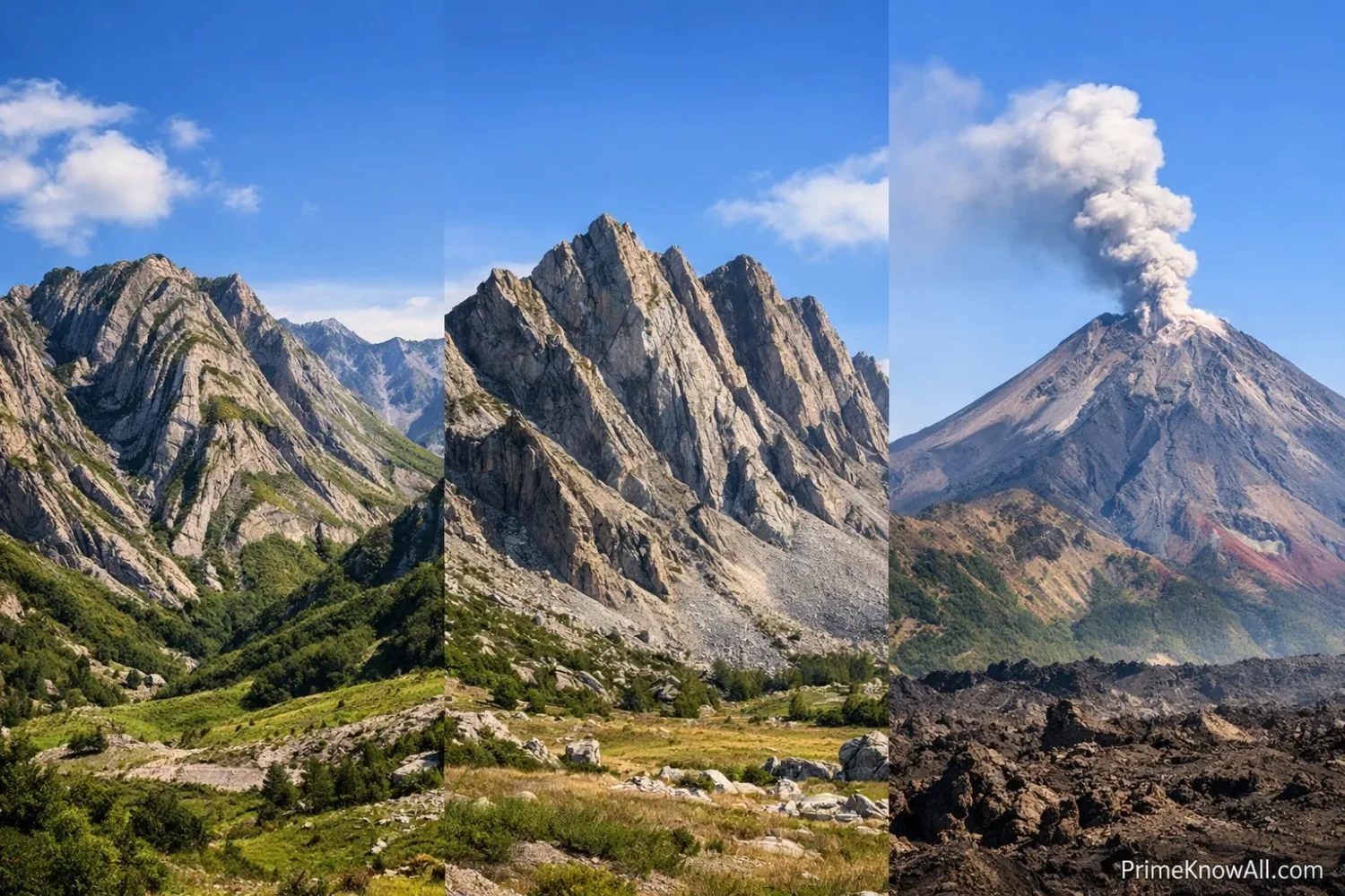
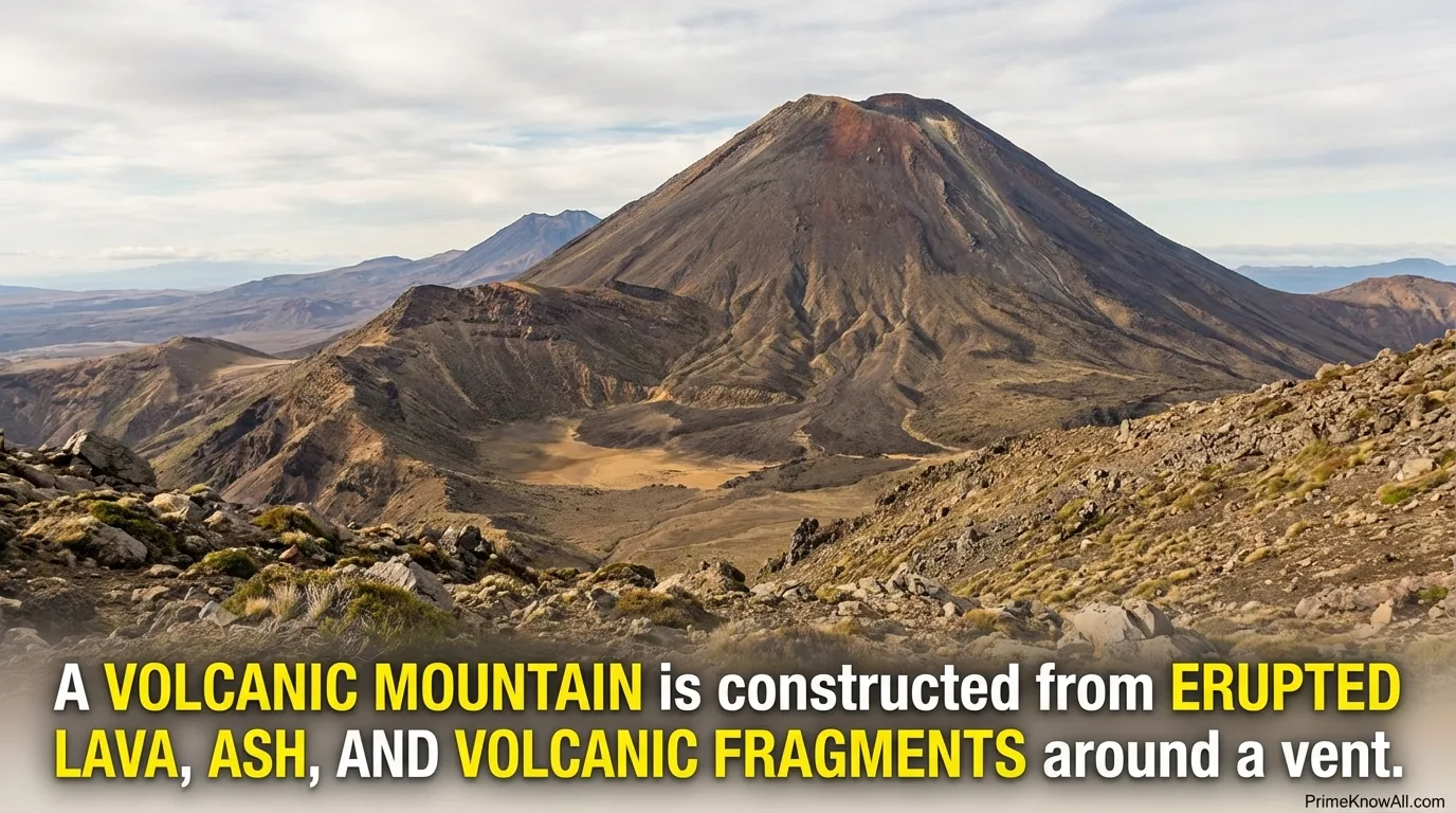
Volcanic mountains can grow quickly in geologic terms if eruptions recur, but their final shape depends on magma chemistry, gas content, and how easily lava flows. That is why some volcanic mountains are steep cones while others are broad domes.
Common Volcano Shapes That Become Mountains
- Shield volcanoes: broad, gently sloping mountains built by fluid lava flows.
- Composite volcanoes (stratovolcanoes): steeper mountains built by alternating layers of lava and ash.
- Cinder cones: smaller, often short-lived mountains made of loose volcanic fragments around a vent.
- Lava domes: mound-like mountains formed by very viscous lava piling up near the vent.
Where Volcanic Mountains Tend To Cluster
Many volcanic mountains form near plate boundaries where melting is common, but volcanic chains can also develop within plates when hot mantle rises and melts beneath the crust. The location is a clue, but the strongest identifier is still the volcanic rock record: flows, ash layers, vents, and intrusive bodies.
- If you can trace lava flows or identify ash layers, treat the mountain as volcanic-built unless strong evidence says otherwise.
- If the peak sits on a broader uplifted belt, it may be volcanic on top of tectonic uplift, not “volcanic only.”
How To Tell The Types Apart In The Real World
Short answer: Use a three-part check: (1) rock layers (bent vs. broken), (2) landscape pattern (continuous belt vs. alternating blocks), and (3) volcanic evidence (vents, lava, ash). With those three, most cases become decidable.
A Comparison Table You Can Save For Later
| Mountain Type | Primary Driver | What It Often Looks Like | Common Field/Map Clues |
|---|---|---|---|
| Fold | Compression and shortening | Long, linear ranges; broad belts | Bent layers, repeated strata, parallel ridges, thrust-related structures |
| Fault-Block | Extension and normal faulting | Alternating basins and ranges; tilted blocks | Straight mountain fronts, escarpments, horst/graben patterns, fault-bounded valleys |
| Volcanic | Eruptions and lava/ash accumulation | Cones, shields, domes; a vent-centered peak | Lava flows, ash layers, craters/calderas, volcanic rock units, vents and dikes |
Two Fast “Reality Checks”
- Hybrid mountains are normal: A range can be largely tectonic with volcanoes sitting on top.
- Erosion is not the builder, but it is the sculptor: erosion can make different mountain types look similar if you only focus on peak shape.
- Trace the pattern: continuous belt (fold) vs. repeating blocks (fault-block).
- Scan rock units for volcanic signatures before labeling a peak “tectonic.”
Everyday Situations That Make This Click
Short answer: The same three forces show up in real life as patterns you can notice—on road trips, in satellite images, or even in how valleys align. These scenarios help anchor fold, fault-block, and volcanic formation in ordinary observation.
- Driving along a long mountain “wall” where ridges run for hours in the same direction. Why: sustained compression tends to build long belts rather than isolated bumps.
- Seeing a sharp, straight mountain front with a broad valley right next to it. Why: a major normal fault can create a clean boundary between uplifted and dropped blocks.
- Noticing a cone-shaped peak that looks layered, with dark flows on the flanks. Why: repeating eruptions stack lava and ash into a volcanic edifice.
- Watching rivers cut deep gorges through rising terrain. Why: uplift can continue while erosion keeps pace, so the landscape records both building and carving.
- Spotting parallel valleys and ridges in satellite view like corrugations. Why: repeated fault blocks or fold belts create organized repetition instead of random relief.
- Finding hot springs near mountains in an area with young volcanic rocks. Why: heat from magma can drive hydrothermal circulation, leaving surface signs.
- Seeing small earthquakes cluster near a mountain range (in public seismic maps). Why: ongoing strain—either compression or extension—often releases energy along faults.
- Fold = bent layers in a long belt.
- Fault-block = broken blocks in repeating steps.
- Volcanic = erupted layers around vents.
Common Misconceptions And What To Replace Them With
Short answer: Many misunderstandings come from judging mountains by shape alone. Better cues are rock structure, fault patterns, and volcanic deposits.
- Misconception: “Pointy mountains are volcanic.” Correction: Pointy peaks can be carved by erosion in any mountain type. Why it’s misunderstood: cones are visually memorable, so the brain overuses the pattern.
- Misconception: “Fold mountains have no faults.” Correction: Many fold belts include major faults, including thrust faults. Why it’s misunderstood: the word “fold” hides the broader deformation system.
- Misconception: “Fault-block mountains only happen at plate boundaries.” Correction: Extension can dominate inside continents in broad provinces. Why it’s misunderstood: tectonics is often taught as only boundary-driven.
- Misconception: “Volcanic mountains are built in one eruption.” Correction: Many are built by repeated eruptions over long periods. Why it’s misunderstood: big eruptions get attention, but construction is cumulative.
- Misconception: “Mountains stop changing once they form.” Correction: many ranges keep evolving as long as uplift and erosion continue. Why it’s misunderstood: human timescales make geologic change feel invisible.
- Misconception: “A mountain must be only one type.” Correction: mixed histories are common: tectonic uplift plus volcanism plus erosion. Why it’s misunderstood: categories are taught as clean boxes, but nature blends them.
A Quick Test You Can Do In Under Two Minutes
Short answer: Read each sentence like a clue set. Decide whether the text points to folding, fault blocks, or volcanism, then open the answer.
1) “Rock layers look like waves, and the ridge runs in the same direction for a very long distance.”
Answer: Fold mountain. The “wave-like layers” point to folding under compression, and the long ridge suggests a belt, not a single cone.
2) “A steep mountain front rises abruptly from a broad valley, and the valley floor sits lower along a straight line.”
Answer: Fault-block mountain. The straight boundary and abrupt rise match a range-bounding fault in an extensional setting.
3) “Dark lava flows radiate from a central summit, and there is a crater near the top.”
Answer: Volcanic mountain. A central vent, crater, and lava flows are direct volcanic indicators.
4) “Ridges and basins repeat across a wide region like alternating bands, and some ranges tilt in the same direction.”
Answer: Fault-block mountains. Repeating basins and ranges, plus tilted blocks, strongly fit crustal extension.
5) “A mountain chain includes many volcanoes on top of a broader uplifted belt near a plate boundary.”
Answer: Mixed system: tectonic uplift plus volcanism. This is common where subduction-related melting adds volcanoes to an already uplifted margin.
- You can classify mountains using structure (bent vs. broken) and materials (volcanic layers or not).
- You can keep room for hybrids instead of forcing a single label.
One-Page Visual Guide
Short answer: This vertical graphic ties each mountain type to a “cause → process → surface clue” chain. It is designed to be scan-friendly while still containing real geologic signals.
Limits Of This Explanation And What We Don’t Know From A Photo Alone
Short answer: Mountain labels are helpful, but they are simplifications. From a single photo, some cases remain ambiguous without rock data, age dating, or structural mapping.
- Many ranges are hybrids: compression can build a belt while extension later breaks it, or volcanoes can grow on top of older uplift.
- Erosion can disguise origins: glaciation and river incision can make very different mountain types look similar in silhouette.
- Timing matters: a mountain may have formed by one mechanism but be maintained by ongoing uplift or isostatic adjustment.
- Local geology changes outcomes: rock strength, pre-existing faults, and crustal thickness can shift the visible result even under the same stress.
- Not covered here: other mountain categories (dome mountains, plateau uplift, residual mountains) exist and can be important in specific regions.
Two-sentence wrap: Mountains form when Earth’s crust is compressed, extended, or built by eruptions. If you focus on structures (bent layers, faults) and materials (lava/ash), the story behind most ranges becomes clear.
Most common mistake: deciding by peak shape alone while ignoring the rock record.
Memorable rule: Force first, shape second—identify the driver, then interpret the landscape.
Sources
U.S. Geological Survey (USGS) – The Himalayas: Two Continents Collide
[Explains Himalayan formation and gives a clear ~40–50 million years start window.] This is reliable because USGS is a primary U.S. government earth-science agency publishing reviewed educational material.
The Geological Society (UK) – Continental Collision: The Himalayas
[Summarizes continental collision and provides an accessible timing statement for Himalayan collision.] This is reliable because it is published by a long-standing professional scientific society.
U.S. National Park Service (NPS) – Tectonic Landforms And Mountain Building
[Connects folding, faulting, extension, and mountain building with real landscapes.] This is reliable because NPS is a U.S. government agency with science/interpretation programs tied to field sites.
U.S. National Park Service (NPS) – Horst And Graben
[Defines horst/graben and describes extension-driven valley-and-range topography, including large stretching over time.] This is reliable because it is a government educational geology page based on established structural geology.
U.S. Geological Survey (USGS) – Volcanoes: Principal Types Of Volcanoes
[Defines major volcano types (cinder cone, composite/stratovolcano, shield, lava dome).] This is reliable because USGS is a primary source for U.S. volcanic hazards and geologic classification.
U.S. National Park Service (NPS) – Types Of Volcanoes
[Explains how magma properties relate to volcano shape and eruption style.] This is reliable because it is produced within a government science communication system that uses consistent terminology.
BCcampus Pressbooks – Physical Geology: Mountain Building
[Explains how folding, faulting, and volcanism interact during orogeny.] This is reliable because it is an open textbook platform used in higher education and typically authored/curated by subject specialists.
National Geographic Education – Fold Mountain
[Provides a clear, non-technical explanation of fold mountain formation and the rug analogy.] This is reliable because it is an established educational reference with editorial standards for general audiences.
FAQ
What is the simplest way to tell fold mountains from fault-block mountains?
Start with rock structure. Fold mountains show bent layers and long belts tied to compression, while fault-block mountains show broken, shifted blocks and repeating basins and ranges tied to extension.
Can one mountain range be both tectonic and volcanic?
Yes. Many regions have tectonic uplift that raises the crust and volcanism that builds cones on top. In that case, the best description is a combined history, not a single label.
How long does it take to build a mountain range?
Major ranges commonly develop over millions to tens of millions of years. The exact duration depends on plate motion rate, rock strength, and how quickly erosion removes material.
What do “horst” and “graben” mean in plain English?
A horst is an uplifted block of crust, and a graben is a dropped block. They form together when normal faults develop as the crust stretches.
Are volcanic mountains always steep cones?
No. Some volcanic mountains are steep stratovolcanoes, but others are broad shield volcanoes built by very fluid lava. The shape reflects how lava flows and how eruptions repeat over time.
Why do some mountains keep rising even while erosion wears them down?
In many settings, uplift continues because tectonic forces persist, and crust can also adjust by isostasy—a buoyancy-like response where removing weight through erosion can allow deeper crust to rise.
Article Revision History