Lake Baikal in Russia is the deepest lake in the world, reaching about 1,642 m (5,387 ft). The next deepest lakes most often cited are Lake Tanganyika in East Africa, the Caspian Sea, and Lake Vostok, a hidden subglacial lake beneath Antarctic ice. Rankings can shift slightly because some lists count only freshwater surface lakes, while others include saline and subglacial lakes.
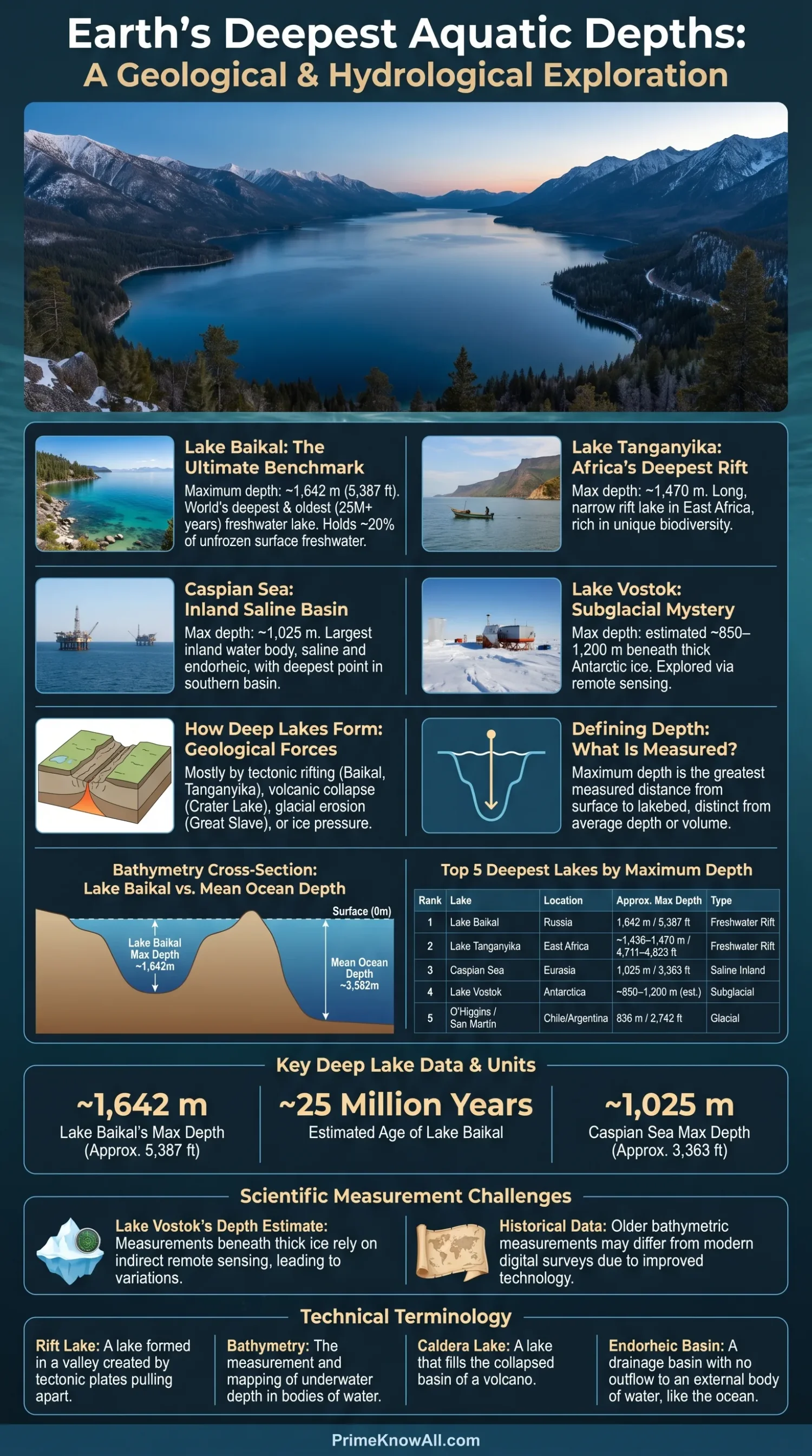
Lake depth sounds simple, but it depends on what is being measured. A lake can be wide and famous yet not very deep, or narrow and remote yet plunge far below the surrounding land. Maximum depth, meaning the greatest measured distance from the water surface to the lakebed, is the usual way to rank the deepest lakes.
If you remember one thing, remember this: the deepest lakes are mostly formed by rift valleys, tectonic basins, volcanic collapse, glacial carving, or subglacial pressure. Their depth is not just a number; it tells a story about how the ground moved, broke, sank, froze, or filled with water over time.
What To Remember First
- Lake Baikal is the deepest known surface lake, at about 1,642 m.
- Lake Tanganyika is the deepest lake in Africa and one of the oldest freshwater lakes.
- The Caspian Sea is often counted because it is an inland water body, although it is saline and called a sea.
- Lake Vostok is hidden under Antarctic ice, so its depth is harder to compare with open lakes.
- Maximum depth is different from area, volume, average depth, and water quality.
The Deepest Lake In The World
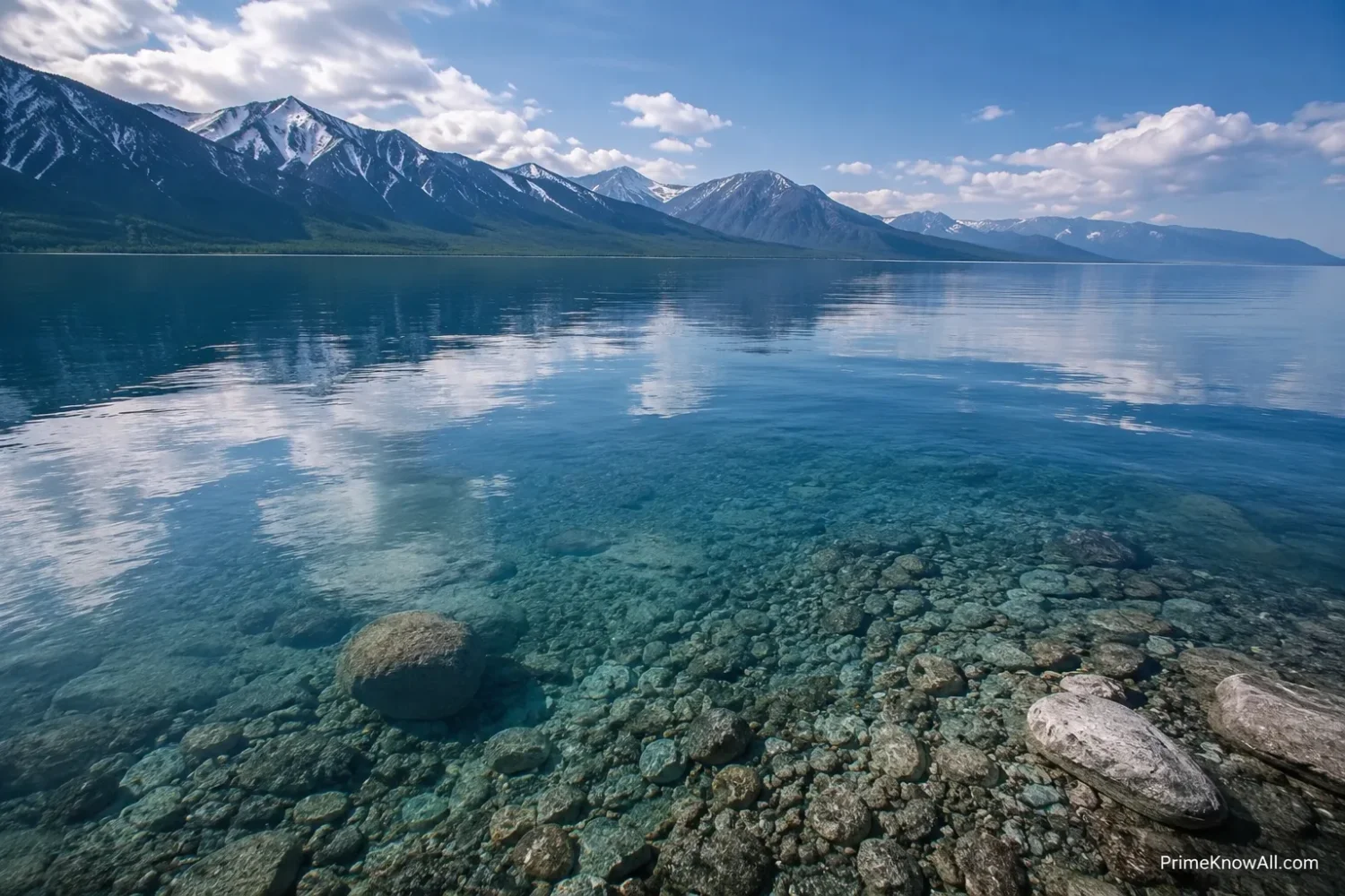
Lake Baikal is the deepest lake in the world by widely accepted maximum-depth measurements. It sits in southern Siberia, inside the Baikal Rift Zone, where the Earth’s crust is slowly pulling apart.
That rift setting matters. Baikal is not simply a bowl that filled with water. It is a long, active geological basin. The lake is also often described as the oldest large freshwater lake, with an age commonly given near 25 million years. Its depth and age help explain why it holds a large share of Earth’s unfrozen freshwater and supports many species found nowhere else.
- Maximum depth: about 1,642 m / 5,387 ft in many modern references.
- Lake type: freshwater rift lake.
- Location: southern Siberia, Russia.
- Why it is so deep: the basin formed where continental crust stretched and sank.
A useful way to picture Baikal is to imagine a long crack in a ceramic plate. If the sides of that crack slowly pull apart and the center drops, water can collect in a very deep, narrow space. That is not a perfect model, but it helps explain why rift lakes can be much deeper than lakes formed only by surface erosion.
The 10 Deepest Lakes Ranked By Maximum Depth
This ranking uses maximum depth, not area or volume. Some values are rounded because lake surveys, older measurements, and newer bathymetric mapping do not always use the same method.
| Rank | Lake | Location | Approx. Maximum Depth | Lake Type |
|---|---|---|---|---|
| 1 | Lake Baikal | Russia | 1,642 m / 5,387 ft | Freshwater rift lake |
| 2 | Lake Tanganyika | Tanzania, DR Congo, Burundi, Zambia | about 1,436–1,470 m / 4,711–4,823 ft | Freshwater rift lake |
| 3 | Caspian Sea | Russia, Kazakhstan, Turkmenistan, Iran, Azerbaijan | 1,025 m / 3,363 ft | Saline inland basin |
| 4 | Lake Vostok | Antarctica | about 850–1,200 m in some estimates | Subglacial lake |
| 5 | O’Higgins / San Martín Lake | Chile and Argentina | 836 m / 2,742 ft | Glacial lake |
| 6 | Lake Malawi / Lake Nyasa | Malawi, Mozambique, Tanzania | 706 m / 2,316 ft | Freshwater rift lake |
| 7 | Issyk-Kul | Kyrgyzstan | 668 m / 2,192 ft | Saline mountain lake |
| 8 | Great Slave Lake | Canada | 614 m / 2,015 ft | Glacial lake |
| 9 | Crater Lake | United States | 594 m / 1,949 ft | Volcanic caldera lake |
| 10 | Lake Matano | Indonesia | 590 m / 1,936 ft | Tectonic tropical lake |
Keep This In Mind
- Depth lists are not all identical because some include the Caspian Sea and Lake Vostok while others exclude them.
- Lake Tanganyika’s depth is often shown with slightly different values because references round or use different survey figures.
- Lake Vostok is harder to rank because it is covered by several kilometers of ice.
Why Some Lakes Become So Deep
The deepest lakes form where the land creates a basin that can drop far below the surrounding surface. Tectonic movement, rifting, volcanic collapse, glacial erosion, and ice pressure are the main processes behind the deepest lake basins.
Rift Lakes
A rift lake is a lake that forms in a long valley where the Earth’s crust stretches and sinks. Lake Baikal, Lake Tanganyika, and Lake Malawi are strong examples. These lakes can be very deep because the basin keeps dropping as the rift system changes.
- Baikal is linked with the Baikal Rift Zone.
- Tanganyika lies along the Western Rift of East Africa.
- Malawi sits in the southern part of the East African Rift system.
Glacial And Volcanic Lakes
A glacial lake forms when ice erodes, blocks, or fills a basin. A volcanic caldera lake forms when a volcano collapses and the basin later fills with water. Great Slave Lake has a glacial history, while Crater Lake sits inside the collapsed basin of Mount Mazama.
- Glacial basins can be deep where ice followed weak rock or older valleys.
- Caldera basins can be steep and clean-sided because collapse created a natural bowl.
- Patagonian lakes such as O’Higgins / San Martín can be deep where glaciers carved narrow valleys near ice fields.
Subglacial Lakes
A subglacial lake is liquid water trapped beneath an ice sheet. Lake Vostok is the best-known example. Heat from below, pressure from above, and insulation by thick ice help keep water from freezing.
Subglacial lakes are not easy to compare with open lakes. Their surfaces cannot be surveyed by boat, and their lakebeds are mapped through radar, gravity, seismic data, and modeling. That is why Lake Vostok’s exact depth is usually presented as an estimate.
Depth Scale For The Ten Deepest Lakes
Each bar compares a lake’s approximate depth with Lake Baikal. The scale is simple, so it helps readers see the gap without turning the page into a math exercise.
1. Lake Baikal — 1,642 m
2. Lake Tanganyika — about 1,436–1,470 m
3. Caspian Sea — 1,025 m
4. Lake Vostok — estimate varies
5. O’Higgins / San Martín — 836 m
6–10. Malawi, Issyk-Kul, Great Slave, Crater, Matano — 706 m to 590 m
Maximum Depth, Average Depth, And Volume Are Different
Maximum depth tells where the deepest measured point is. Average depth describes the lake’s overall shape. Volume tells how much water the lake holds. A lake can rank high in one measure and lower in another.
This is why lake rankings can confuse readers. Lake Superior, for example, is the deepest of the North American Great Lakes and one of the largest lakes by surface area, yet it is not close to Baikal or Tanganyika by maximum depth. Crater Lake is much smaller in area, but its steep caldera gives it an unusually high average depth for its size.
- Maximum depth: best for “deepest lake” rankings.
- Average depth: useful for understanding basin shape.
- Volume: useful for comparing water storage.
- Surface area: useful for maps, coastlines, and climate influence.
Small Note Before Comparing Numbers
- One deep trench can lift a lake’s rank even if much of the lake is shallower.
- Area does not equal depth; the Caspian Sea is huge, but Baikal is deeper.
- Old survey data may be replaced or refined as mapping improves.
Profiles Of The Deepest Lakes
Each deep lake has a different reason for being deep. The short profiles below explain the geology, location, and depth context without turning the ranking into a bare list.
Lake Baikal
Lake Baikal is the benchmark for deep lakes. Its rift basin, long age, oxygen-rich deep water, and unusual species make it a reference point for freshwater science. Its depth also creates a large water volume even though its surface area is not the largest among lakes.
Lake Tanganyika
Lake Tanganyika is the second deepest surface freshwater lake by common rankings. It is long, narrow, and linked to the East African Rift. Its depth supports layered water conditions, and its shoreline is shared by several countries, making it both a natural system and a daily resource for fishing, transport, and local economies.
Caspian Sea
The Caspian Sea is an inland saline water body. It is often counted in lake lists because it has no open connection to the ocean, but many readers pause at the name “sea.” Its southern basin contains the deepest point, while the northern part is much shallower.
Lake Vostok
Lake Vostok lies under the East Antarctic Ice Sheet. It is a rare case where the lake is known mostly through instruments rather than direct observation. Its depth range is less settled than Baikal’s or Tanganyika’s, but it belongs in any serious discussion of deep lakes because of its size and hidden setting.
O’Higgins / San Martín Lake
O’Higgins / San Martín Lake sits between Chile and Argentina. It is strongly shaped by Patagonian ice and steep terrain. Its milky blue water is linked with fine rock flour carried by glaciers, and its deepest point is near the O’Higgins Glacier.
Lake Malawi / Lake Nyasa
Lake Malawi, also called Lake Nyasa, is another deep East African Rift lake. It is known for cichlid fish diversity and for its long, trench-like basin. Its deepest area lies in the northern and central parts of the lake.
Issyk-Kul
Issyk-Kul is a high mountain lake in Kyrgyzstan. It is saline and endorheic, meaning it has no normal river outlet. Its name is often translated as “warm lake,” linked with the fact that it does not usually freeze fully in winter despite its mountain setting.
Great Slave Lake
Great Slave Lake is the deepest lake in North America by maximum depth. Its deepest known area is in the eastern part of the lake, where the basin is much steeper and clearer than many shallow northern lakes.
Crater Lake
Crater Lake in Oregon is the deepest lake in the United States. It formed after Mount Mazama collapsed, leaving a caldera that later filled mostly through rain and snow. Its lack of large inflowing rivers helps keep sediment input low.
Lake Matano
Lake Matano in Sulawesi, Indonesia, is a deep tropical tectonic lake. It is much smaller than Baikal or Tanganyika, but its lakebed drops sharply enough to place it among the deepest known lakes.
Common Misconceptions About Deep Lakes
Deep-lake rankings are easy to misread because familiar lakes are not always the deepest. A map shows surface area; a depth chart shows the hidden shape below the water.
| Misconception | Better Way To Understand It | Why It Happens |
|---|---|---|
| The largest lake must be the deepest. | Not always. Surface area and maximum depth measure different things. | Maps make wide lakes look more impressive than narrow deep basins. |
| The Caspian Sea cannot be in a lake list. | It can be included as an inland saline basin, but the label should be explained. | The word “sea” makes it sound like part of the ocean. |
| Lake Vostok has one exact public depth number. | Its depth is still estimate-based because it is under thick ice. | Many rankings prefer a neat number, even when the science is less tidy. |
| A deep lake is always cold at every level. | Deep water conditions depend on climate, mixing, salinity, oxygen, and shape. | People often connect depth with cold water only. |
| All deep lakes are safe to visit in the same way. | Visitor access depends on weather, roads, shoreline rules, water temperature, and local protection. | Ranking articles usually focus on numbers, not practical conditions. |
Where Deep Lake Knowledge Shows Up In Real Life
Deep lakes are not only trivia answers. Their depth affects travel, science, climate records, water safety, local economies, and conservation planning.
- A visitor checks a lake viewpoint and expects a beach day. Deep lakes such as Crater Lake can have cold water and limited shoreline access, so scenery does not always mean easy swimming.
- A student compares Lake Superior with Lake Baikal. Superior is huge by surface area, but Baikal is much deeper, which shows why one ranking cannot answer every lake question.
- A documentary mentions Lake Vostok and icy moons. Subglacial lakes interest scientists because dark, high-pressure water can help shape ideas about life in hidden water systems beyond Earth.
- A map app shows the Caspian Sea as a sea. The name is normal, but physically it is an inland basin with no open ocean outlet.
- A fisherman works on Lake Tanganyika. Deep, layered water can affect where fish live, where nutrients move, and how local communities use the lake.
- A geography class studies rift valleys. Baikal, Tanganyika, and Malawi make the lesson easier because each lake sits in a deep basin tied to crust movement.
- A park manager reviews lake access. Deep lakes can have steep shorelines, fragile paths, and cold water risks, so visitor routes need careful design.
Worth Holding Onto
- Depth changes the whole lake, not just the number beside its name.
- Deep basins store old clues in sediment, water layers, and biological patterns.
- Visitor access can be limited even when a lake is famous and well protected.
Quick Test
Use these short checks to confirm the main ideas. Each answer opens only when needed.
1. If a lake is very wide, is it automatically one of the deepest lakes?
No. Width and surface area do not prove depth. Maximum depth measures the deepest point from the surface to the lakebed.
2. Why is Lake Baikal deeper than most famous lakes?
Lake Baikal sits in a rift basin, where crust movement created a long, deep depression that filled with freshwater.
3. Why do some lists include the Caspian Sea?
The Caspian Sea is an inland saline water body with no open ocean outlet, so many lake rankings include it with a note about its name and salinity.
4. Why is Lake Vostok’s depth less certain?
Lake Vostok lies beneath thick Antarctic ice. Its basin is mapped through remote methods, so estimates can differ between studies.
5. Which deep lake is the deepest in the United States?
Crater Lake in Oregon is the deepest lake in the United States, with a maximum depth of about 594 m / 1,949 ft.
Limits Of This Explanation
Depth rankings are useful, but they are not perfect. Bathymetry, meaning the measurement and mapping of underwater depth, can improve over time as instruments, survey coverage, and data models improve.
- Lake Vostok has a wider uncertainty range because it is subglacial.
- Older lake measurements may use different survey methods from newer maps.
- Some rankings exclude saline or hidden lakes, which changes the order after the top two.
- Depth alone does not describe ecology, water quality, visitor access, or cultural value.
The safest reading is this: Baikal is the deepest open surface lake, Tanganyika follows among surface freshwater lakes, and the remaining order depends on whether the list includes saline inland basins and subglacial lakes.
Sources
The sources below were chosen because they come from official institutions, edited reference works, or research-focused organizations with topic-specific pages.
- UNESCO World Heritage Centre – Lake Baikal — Useful for Baikal’s World Heritage status, age, freshwater value, and depth context; UNESCO is a formal international heritage authority.
- Encyclopaedia Britannica – Lake Tanganyika — Useful for Tanganyika’s length, location, and depth; Britannica is edited and fact-checked.
- Encyclopaedia Britannica – Caspian Sea — Useful for the Caspian’s inland-basin status, area, and maximum depth; the page gives a clear physical geography summary.
- AntarcticGlaciers.org – Subglacial Lakes — Useful for explaining Lake Vostok and subglacial lake processes; the site is run by glacier scientists and focuses on polar science education.
- National Academies Press – Exploration Of Antarctic Subglacial Aquatic Environments — Useful for the limits and survey context around Antarctic subglacial lakes; the National Academies publish peer-reviewed science reports.
- NOAA – Lake Superior — Useful for Great Lakes depth context and monitored lake indicators; NOAA is a U.S. science agency with operational environmental data.
- USGS – Geology Of Crater Lake National Park — Useful for Crater Lake’s volcanic origin and maximum depth; USGS is a primary U.S. geoscience agency.
- Encyclopaedia Britannica – Lake Ysyk — Useful for Issyk-Kul’s depth, area, and mountain-lake setting; Britannica provides a concise edited reference page.
The deepest lakes are deep because their basins were made by powerful geological or ice-related processes, not because they are simply large on a map. Baikal remains the clear leader, while Tanganyika, the Caspian Sea, Vostok, and the Patagonian and rift lakes show how different basin types can reach extreme depths.
The most common mistake is to compare lakes by area when the question is about depth. A good rule is simple: for “deepest,” ask for maximum depth; for “largest,” ask whether the ranking means area or volume.
FAQ
What is the deepest lake in the world?
Lake Baikal in Russia is the deepest lake in the world, reaching about 1,642 m / 5,387 ft at its deepest measured point.
What is the second deepest lake in the world?
Lake Tanganyika in East Africa is usually listed as the second deepest surface lake. Its commonly cited maximum depth is about 1,436–1,470 m, depending on the reference.
Is the Caspian Sea a lake?
The Caspian Sea is often treated as the world’s largest inland water body. It is saline and called a sea, but many lake rankings include it because it has no open connection to the ocean.
Why is Lake Vostok hard to rank?
Lake Vostok sits beneath several kilometers of Antarctic ice. Its depth is estimated through remote measurements and models, so different sources may give different values.
What is the deepest lake in North America?
Great Slave Lake in Canada is the deepest lake in North America, reaching about 614 m / 2,015 ft.
What is the deepest lake in the United States?
Crater Lake in Oregon is the deepest lake in the United States, with a maximum depth of about 594 m / 1,949 ft.
Are the deepest lakes also the largest lakes?
Not always. A lake can have a huge surface area but a modest depth, or a smaller surface area with a very deep basin. Depth, area, and volume are separate measurements.