The world’s largest desert is Antarctica, not the Sahara, because a desert is defined mainly by dryness, not heat. The Arctic Desert ranks second, and the Sahara is the largest hot desert on Earth.
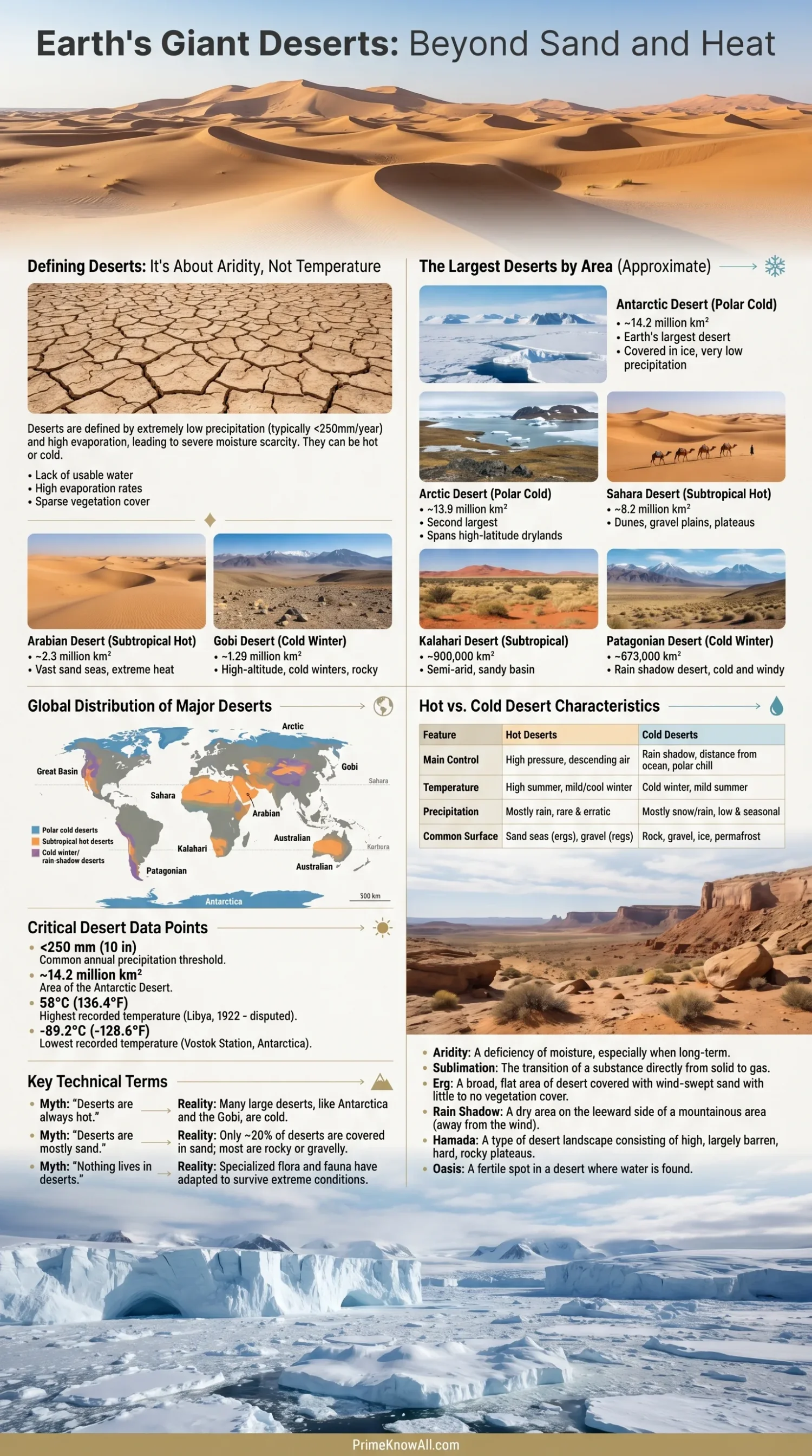
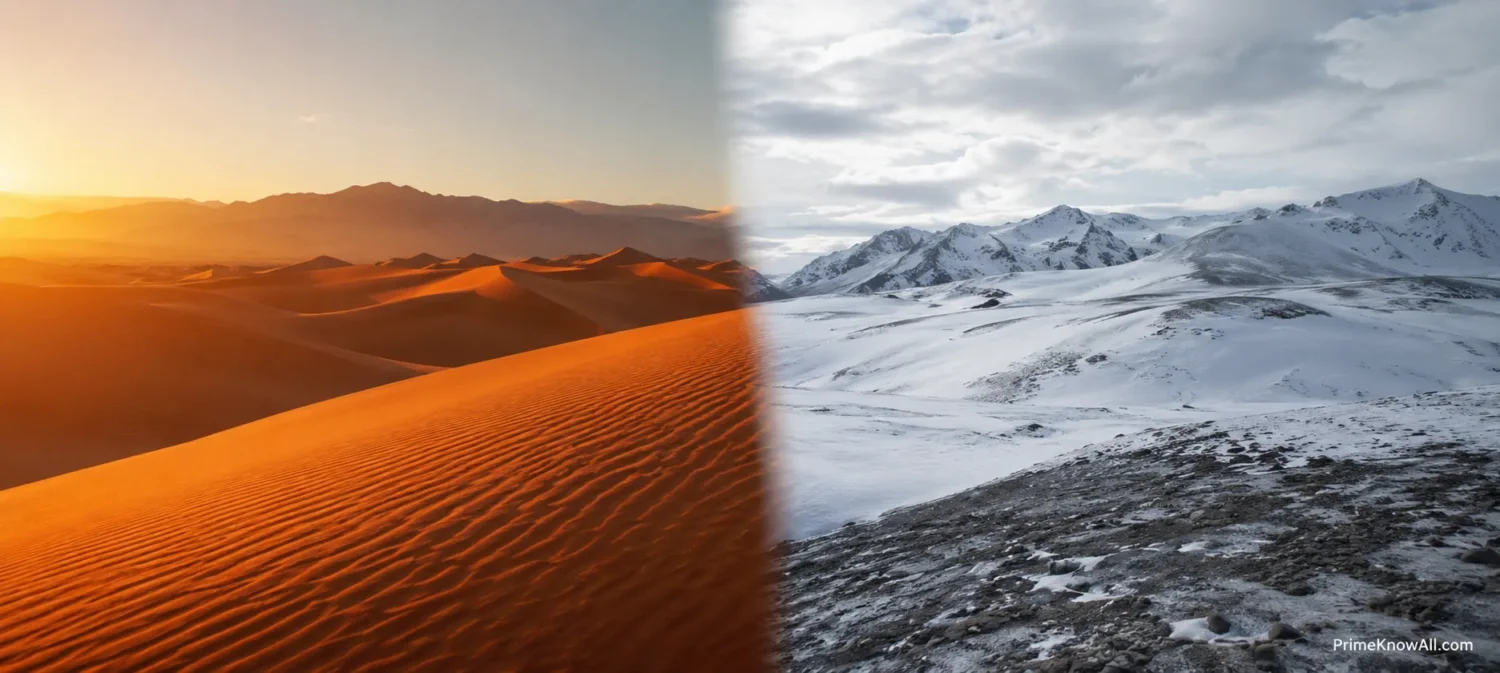
Deserts are places where water is scarce for plants, soils, rivers, animals, and people. Some are blazing hot, some are locked in ice, and many sit between those extremes. The main question is not “Is it sandy?” but how little usable moisture reaches the land.
If you remember one thing: Antarctica is the largest desert overall, the Arctic is the second largest, and the Sahara is the largest hot desert. Size lists can vary slightly because desert borders are not always drawn the same way.
What Makes A Desert A Desert?
A desert is a dry landscape where annual precipitation is low and available water is limited. Many references use about 250 millimeters, or 10 inches, of precipitation per year as a common desert threshold, but evaporation, wind, snow storage, soil moisture, and plant cover also matter.
- Precipitation means rain, snow, sleet, or other water that falls from the atmosphere.
- Aridity means dryness caused by low precipitation, high evaporation, or both.
- Evaporation is water leaving soil, lakes, and surfaces as vapor.
- Transpiration is water released by plants; together with evaporation it helps explain why some places feel drier than rainfall numbers alone suggest.
This is why an icy continent can beat every sandy landscape in a desert ranking. Cold air holds little moisture, and Antarctica receives very little precipitation across much of its interior.
Keep This In View
- Dryness matters more than temperature.
- Sand is not required; many deserts are rocky, icy, gravelly, or salty.
- Area rankings are approximate because desert edges blend into semi-arid land.
Largest Deserts By Area
The largest deserts cover huge climate zones, not just single dune fields. The table below uses rounded area estimates, because several deserts shift in size depending on whether nearby semi-desert, tundra, steppe, or connected basins are included.
| Rank | Desert | Main Type | Approximate Area | Main Region | Why It Counts |
|---|---|---|---|---|---|
| 1 | Antarctic Desert | Polar cold desert | About 14.2 million km² / 5.5 million mi² | Antarctica | Very low snowfall over a vast ice-covered continent |
| 2 | Arctic Desert | Polar cold desert | About 13.7–13.9 million km² / 5.3–5.4 million mi² | Arctic lands and polar islands | Large high-latitude dry zones with limited precipitation |
| 3 | Sahara Desert | Hot subtropical desert | About 8.6–9.2 million km² / 3.3–3.6 million mi² | North Africa | Largest hot desert, with dunes, rock plateaus, gravel plains, and dry basins |
| 4 | Arabian Desert | Hot subtropical desert | About 2.3 million km² / 900,000 mi² | Arabian Peninsula | Vast dry region including the Rubʿ al Khali, one of the largest sand seas |
| 5 | Gobi Desert | Cold winter desert | About 1.3 million km² / 500,000 mi² | Mongolia and northern China | Dry interior basin with harsh winters and broad rocky surfaces |
| 6 | Kalahari Desert | Subtropical dryland desert region | About 930,000 km² / 360,000 mi² | Southern Africa | Dry basin with sand sheets, grasslands, scrub, and seasonal water limits |
| 7 | Patagonian Desert | Cold desert / rain shadow desert | About 670,000 km² / 260,000 mi² | Argentina and Chile | Dry leeward side of the Andes, shaped by wind and mountain rain shadow |
| 8 | Great Victoria Desert | Hot to temperate desert | About 350,000–650,000 km², depending on boundary method | Southern Australia | Australia’s largest desert region, with dunes, salt lakes, and spinifex grasslands |
Why Antarctica Is The Largest Desert
Antarctica is the largest desert because most of the continent receives very little precipitation, even though it is covered by ice. The ice is not proof of a wet climate; it is the result of snow building up slowly over long periods and rarely melting in the cold interior.
- Size: Antarctica covers about 14.2 million square kilometers.
- Moisture: much of the interior receives very low annual precipitation, mostly as snow.
- Temperature: cold air holds less water vapor than warm air, so the atmosphere can stay very dry.
- Surface: ice sheets, glaciers, exposed rock, dry valleys, and wind-polished snowfields all appear within the Antarctic desert system.
A useful way to picture it: a desert is like a bank account with almost no deposits. Antarctica has a huge frozen balance from long-term accumulation, but the yearly “income” of new water is small across much of the interior. That is why it still belongs in a desert ranking.
The McMurdo Dry Valleys Show The Idea Clearly
The McMurdo Dry Valleys are often used as a clear example of Antarctic aridity. They are cold, windy, rocky, and extremely dry. In some areas, exposed ground remains visible because wind, low snowfall, and sublimation remove or limit snow cover.
- Sublimation means ice changing directly into vapor without becoming liquid water first.
- Katabatic winds are dense cold winds that flow downhill from the Antarctic ice sheet.
- Polar desert means a cold desert found in a polar region, where water is limited mainly by low precipitation and frozen conditions.
What This Means
- Ice cover does not cancel desert status.
- Low precipitation is the main reason Antarctica ranks first.
- Cold deserts can be larger than hot deserts.
Why The Sahara Is Still The Largest Hot Desert
The Sahara is the largest hot desert and the third-largest desert overall. It stretches across North Africa from the Atlantic side toward the Red Sea region and covers a changing area often estimated between 8.6 and 9.2 million square kilometers.
Many people picture the Sahara as one endless dune field, but that is too simple. Much of the Sahara is rock, gravel, plateau, mountain, salt flat, dry basin, and stony plain. Sand seas, called ergs, are only one part of the landscape.
- Erg: a large area covered by sand dunes.
- Reg: a desert pavement or gravel plain.
- Hamada: a rocky desert plateau.
- Chott: a salt lake or salt flat that may hold water after rare rain.
- Oasis: a place where groundwater reaches the surface or can support plants and settlement.
The Sahara Also Affects Places Far Away
The Sahara is not just a map label. NASA satellite studies have shown that Saharan dust can travel across the Atlantic, with large average yearly dust flows leaving West Africa. Some of that dust carries minerals that can reach the Amazon Basin and the Caribbean region.
This does not mean the Sahara “feeds” every forest in a simple way. It means desert dust is part of a wider Earth system that connects wind, soil, oceans, rainfall, and ecosystems.
Hot Deserts And Cold Deserts Compared
Hot deserts are dry places where heat strongly shapes daily life, plant survival, and evaporation. Cold deserts are dry places where low temperatures, snow, frost, or long winters are major controls. Both are deserts because water is limited.
| Feature | Hot Deserts | Cold Deserts | Polar Deserts |
|---|---|---|---|
| Main Control | Heat, evaporation, dry descending air | Low precipitation, winter cold, rain shadow effects | Cold air, snow scarcity, frozen water |
| Common Surface | Sand, gravel, rock, salt flats | Rock, gravel, steppe, dry basins | Ice, snow, exposed rock, dry valleys |
| Examples | Sahara, Arabian, Sonoran, Namib | Gobi, Patagonian, Great Basin | Antarctic Desert, Arctic Desert |
| Daily Pattern | Can be very hot by day and cooler at night | Wide seasonal range, cold winters | Long polar seasons, strong cold, low sunlight in winter |
| Main Misread | People assume all hot deserts are mostly sand | People overlook them because they may have shrubs or grass | People reject them as deserts because they contain ice |
Useful Split
- Hot desert does not mean lifeless sand.
- Cold desert does not mean wet land.
- Polar desert is a cold desert where frozen water may be present but liquid water is scarce.
The Top Deserts Explained One By One
The largest deserts are easier to understand when each one is treated as a real region, not just a line in a ranking. Their boundaries, climates, and surfaces differ more than the word “desert” suggests.
Antarctic Desert
The Antarctic Desert is the largest desert on Earth. Its scale comes from the size of the continent, while its desert status comes from low precipitation, especially across the high interior plateau.
- Main type: polar cold desert.
- Surface: ice sheet, dry valleys, exposed rock, glacier ice, snowfields.
- Main lesson: a place can be full of ice and still be extremely dry.
Arctic Desert
The Arctic Desert is not one neat continent. It includes dry polar lands, islands, and high-latitude zones across parts of North America, Greenland, northern Europe, and northern Asia. The exact area depends on where the polar desert boundary is drawn.
- Main type: polar cold desert and dry tundra zones.
- Surface: permafrost, ice, rock, sparse vegetation, snow cover.
- Main lesson: cold land can be dry because the atmosphere carries little moisture.
Sahara Desert
The Sahara is Earth’s largest hot desert. It includes parts of many North African countries and contains some of the best-known desert landforms: ergs, stony plateaus, dry valleys, salt flats, mountain massifs, and oases.
- Main type: hot subtropical desert.
- Surface: sand seas, rock plateaus, gravel plains, dry basins.
- Main lesson: the Sahara is more varied than the simple “sand desert” image.
Arabian Desert
The Arabian Desert covers much of the Arabian Peninsula. Its most famous part is the Rubʿ al Khali, or Empty Quarter, a huge sand desert shared across parts of Saudi Arabia, Oman, the United Arab Emirates, and Yemen.
- Main type: hot subtropical desert.
- Surface: dunes, gravel plains, escarpments, salt flats.
- Main lesson: large sand seas are only part of a broader desert region.
Gobi Desert
The Gobi is a cold winter desert across Mongolia and northern China. It is dry, windy, and harsh, but it is not mostly sand. Much of it is bare rock, gravel, steppe, and basin land.
- Main type: cold winter desert.
- Surface: rock, gravel, sparse grassland, dry basins.
- Main lesson: winter cold can be part of a true desert climate.
Kalahari Desert
The Kalahari is a large dry basin in southern Africa. It receives more rain than the driest deserts, so some geographers treat parts of it as semi-arid rather than fully desert. Even so, it is widely included in major desert lists because water remains a limiting force across the region.
- Main type: subtropical dryland desert region.
- Surface: sand sheets, scrub, grassland, dry river channels.
- Main lesson: desert regions can support wildlife and vegetation where seasonal rain allows it.
Patagonian Desert
The Patagonian Desert sits mainly in Argentina, with influence from the Andes. It is a classic rain shadow desert, meaning mountains block moist air and leave the leeward side dry.
- Main type: cold desert.
- Surface: steppe, gravel plains, dry plateaus, wind-shaped land.
- Main lesson: mountains can create dryness even outside the tropics.
Great Victoria Desert
The Great Victoria Desert is Australia’s largest desert region. It stretches across Western Australia and South Australia and includes dunes, salt lakes, spinifex grasslands, and remote dry country.
- Main type: hot to temperate desert.
- Surface: dunes, salt pans, low vegetation, stony areas.
- Main lesson: desert landscapes can be patterned, vegetated, and culturally important, not empty land.
Ranking Reminder
- Antarctica is first because of scale and dryness.
- Sahara is first only when the category is hot deserts.
- Border choices explain why area numbers differ between references.
Why Desert Borders Are Hard To Measure
Desert borders are not fences. They fade into semi-desert, steppe, tundra, scrubland, savanna, mountains, salt flats, and dry basins. That is why one reference may list the Sahara near 8.6 million km², while another uses about 9.2 million km².
- Rainfall changes from year to year, especially near desert margins.
- Vegetation zones can shift after wet or dry periods.
- Mapping methods may include or exclude semi-arid edges.
- Political borders rarely match climate borders.
- Polar deserts are harder to define because tundra, ice sheet, sea ice, and land boundaries interact.
A careful desert ranking should therefore use words such as about, roughly, or estimated. Exact-looking numbers can be less honest than rounded ones when the boundary itself is fuzzy.
What The Biggest Deserts Tell Us About Climate
The largest deserts form where the climate system limits moisture. That can happen under high-pressure belts, behind mountains, near cold ocean currents, deep inside continents, or close to the poles.
Subtropical High Pressure
Many hot deserts sit near subtropical latitudes where dry air often sinks. Sinking air warms and suppresses cloud formation, which helps explain the Sahara, Arabian Desert, and other hot dry belts.
Rain Shadow Effects
A rain shadow is a dry zone on the leeward side of a mountain range. Moist air rises on one side, loses water as rain or snow, then descends drier on the other side. The Patagonian Desert is a clear example.
Cold Ocean Currents
Cold ocean currents can cool nearby air and reduce the amount of moisture that rises into rain clouds. This helps explain why coastal deserts such as the Atacama and Namib can be so dry despite being near the ocean.
Continental Interiors
Places far from warm ocean moisture can become dry because air loses water before it arrives. The Gobi shows this pattern well: it lies deep inside Asia and also feels the effect of surrounding mountain systems.
Polar Dryness
Polar deserts form because cold air has a limited ability to hold water vapor. Snow may stay on the ground for long periods, but the amount added each year can be small.
Climate Pattern To Notice
- Hot deserts often form under dry, sinking air.
- Cold deserts often form through distance, mountains, and winter cold.
- Polar deserts prove that frozen land can still lack fresh precipitation.
Where The Ranking Shows Up In Real Life
Desert rankings are not trivia only. They help explain weather reports, satellite images, travel planning, wildlife patterns, and even why certain landscapes are used for space research.
- A child asks why Antarctica is a desert: the answer is low precipitation, not sand. This corrects the most common classroom confusion.
- A weather map shows Saharan dust over the Atlantic: the Sahara is large enough to influence skies, sunsets, air quality, and nutrient transport far from Africa.
- A traveler expects endless dunes in the Gobi: much of the Gobi is rocky or gravelly, so the “sand-only” image leads to poor expectations.
- A documentary calls the Kalahari a desert with wildlife: this is possible because some desert regions receive seasonal rain and support grasses, shrubs, insects, birds, and mammals.
- A map labels Patagonia as dry steppe: that does not fully conflict with calling it a desert region; border zones often sit between desert and semi-arid categories.
- A science article compares Atacama soils with Mars-like conditions: very dry non-polar deserts help researchers study slow surface change and life under water stress.
- A construction story mentions desert sand: wind-rounded desert sand is not always ideal for concrete, showing that “having sand” and “having usable sand” are different things.
A Text-Based Desert Size View
The scale difference becomes clearer when the largest deserts are placed in a simple visual order. Antarctica and the Arctic are in a separate size class from every hot desert.
Largest Desert Ranking By Approximate Area
Dryness, not heat, decides the category.
1. Antarctic Desert — 14.2 million km²
Polar cold desert; ice-covered but very dry.
2. Arctic Desert — about 13.7–13.9 million km²
Polar desert zones across the far north.
3. Sahara Desert — about 8.6–9.2 million km²
Largest hot desert; sand is only part of it.
4. Arabian Desert — about 2.3 million km²
Large hot desert region of the Arabian Peninsula.
5. Gobi Desert — about 1.3 million km²
Cold winter desert with rock, gravel, and dry basins.
Common Misconceptions About The Largest Deserts
Deserts are often explained with simple images: sand, heat, camels, empty horizons. Those images cover only part of the topic. The corrections below make the ranking easier to trust.
| Misconception | Correction | Why It Happens |
|---|---|---|
| “The Sahara is the world’s largest desert.” | The Sahara is the largest hot desert, but Antarctica is the largest desert overall. | People often connect the word desert with heat and sand. |
| “A desert must be sandy.” | Many deserts are rocky, icy, gravelly, salty, or partly vegetated. | Dune images are more familiar than desert pavements or polar ice sheets. |
| “Ice means a place cannot be a desert.” | Ice can exist where new precipitation is very low and melting is limited. | People confuse stored frozen water with a wet climate. |
| “Cold deserts are just tundra.” | Some cold deserts overlap with tundra-like landscapes, but the desert label depends on dryness. | Vegetation and temperature categories can overlap on real maps. |
| “Area rankings are exact.” | Most desert sizes are estimates because borders fade into nearby drylands. | Tables make fuzzy climate boundaries look sharper than they are. |
Recent Desert Science Worth Noting
Recent research keeps refining how scientists think about desert age and formation. A 2026 Nature Communications study on the Atacama Desert reported evidence that extreme aridity in its hyperarid core may have begun around 45 million years ago, earlier than many older explanations suggested.
That does not change the largest-desert ranking, because the Atacama is not among the largest by area. It matters because it shows how deserts can record long climate histories in stones, soils, salts, and surfaces that change very slowly when water is rare.
- Largest by area: Antarctica.
- Largest hot desert: Sahara.
- Driest non-polar desert often cited in science: Atacama.
- Old dry surfaces: useful for understanding climate, erosion, and life in low-water settings.
Science Note
- Largest and driest are different measurements.
- Area ranks deserts by map size.
- Aridity ranks them by water shortage and climate behavior.
Limitations And What We Do Not Know Exactly
Desert data has limits because climate zones do not end at sharp lines. Most large deserts have margins that move or grade into nearby drylands. Polar deserts add another challenge because researchers may classify land, ice, tundra, and islands differently.
- Area estimates vary between sources because boundaries vary.
- Rainfall records are uneven in remote regions such as Antarctica, the deep Sahara, and central Asian basins.
- Seasonal change matters because a place may look greener after rain but still remain dry over the long term.
- Climate categories overlap, especially around semi-arid margins.
- Human land use can change vegetation cover, but it does not automatically create or erase a climatic desert.
The safest reading is this: use rounded desert areas, compare the same category each time, and separate largest overall from largest hot desert.
Quick Test
Use these short checks to test the main idea. Click each line to reveal the answer.
1. “The Sahara is the largest desert on Earth.”
Not quite. The Sahara is the largest hot desert, but Antarctica is the largest desert overall.
2. “A place can be icy and still be a desert.”
Correct. If precipitation is very low and usable water is limited, an icy region can be a cold desert or polar desert.
3. “All deserts are covered mostly by sand dunes.”
Incorrect. Many deserts include rock plains, gravel surfaces, salt flats, dry valleys, ice sheets, and sparse vegetation.
4. “The Gobi is a hot desert like the Sahara.”
Incorrect. The Gobi is a cold winter desert with harsh seasonal temperature changes.
5. “Desert size numbers can differ between references.”
Correct. Desert margins are often gradual, so area estimates change depending on the mapping method.
How To Read Any Desert Ranking
A good desert ranking should tell readers what it is ranking: largest overall, largest hot desert, driest desert, oldest desert, or largest sand sea. These are not the same question.
- Largest overall: Antarctic Desert.
- Largest hot desert: Sahara Desert.
- Largest sand sea often discussed: Rubʿ al Khali within the Arabian Desert region.
- Notable dry research landscape: Atacama Desert.
- Major cold winter desert: Gobi Desert.
Two sentences are enough to hold the full idea: Earth’s largest deserts are cold because deserts are measured by water shortage, not heat. The Sahara remains the largest hot desert, but it ranks behind Antarctica and the Arctic when all desert types are counted.
The most common mistake is treating desert as a synonym for sand. The rule to remember is simple: first ask how dry the place is, then ask whether it is hot or cold.
Sources
- Deserts of the World – Largest Deserts in the World — Useful for comparing the world’s largest deserts by area and separating overall desert rankings from hot desert rankings; relevant as a focused desert reference page.
- U.S. Geological Survey – Deserts — Useful for the common precipitation threshold and for explaining deserts as dry ecosystems; reliable because USGS is a U.S. science agency.
- U.S. Geological Survey – What Is A Desert? — Helpful for the idea that deserts may be hot or cold; reliable because it is an official USGS educational publication.
- NASA – Frequently Asked Questions About Antarctica — Supports the explanation that Antarctica is considered a desert due to very low rain and snowfall; reliable because NASA provides polar science education and satellite research context.
- British Antarctic Survey – Antarctic Factsheet — Provides concise Antarctic climate facts, including desert status and snowfall comparison; reliable because BAS is a leading polar research institution.
- NOAA Arctic Report Card – Precipitation 2025 — Useful for Arctic precipitation patterns and polar desert conditions; reliable because NOAA publishes monitored climate assessments.
- NASA Goddard – Saharan Dust And The Amazon — Supports the section on dust transport from the Sahara; reliable because it summarizes satellite-based NASA research.
- Encyclopaedia Britannica – Sahara Desert — Useful for Sahara area and physical geography; reliable as an edited reference source with topic-specific entries.
- Encyclopaedia Britannica – Arabian Desert — Provides area and regional description for the Arabian Desert; reliable as a long-running edited reference source.
- Encyclopaedia Britannica – Gobi Desert — Supports the Gobi’s area, location, and non-sandy character; reliable as an edited geography reference.
- Nature Communications – Evidence For Eocene Aridification Of The Atacama Desert’s Hyperarid Core — Supports the recent note on Atacama aridity timing; reliable because it is a peer-reviewed scientific paper.
FAQ
What Is The Largest Desert In The World?
The largest desert in the world is the Antarctic Desert. It covers about 14.2 million square kilometers and is classified as a desert because it receives very little precipitation.
Is The Sahara The Largest Desert?
The Sahara is the largest hot desert, but it is not the largest desert overall. Antarctica and the Arctic are larger when cold deserts are included.
Why Is Antarctica Called A Desert?
Antarctica is called a desert because much of it receives very little precipitation. Most water there is locked as ice, and new snowfall is limited across large interior areas.
What Is The Second Largest Desert?
The Arctic Desert is usually listed as the second largest desert. Its exact area varies by source because the Arctic includes land, islands, tundra zones, and polar dry regions.
What Is The Largest Hot Desert?
The Sahara Desert is the largest hot desert. It covers much of North Africa and includes sand seas, rocky plateaus, gravel plains, dry basins, and oases.
Are All Deserts Hot?
No. Some deserts are cold, including the Antarctic Desert, Arctic Desert, Gobi Desert, and Patagonian Desert. Dryness is the shared feature.
Are All Deserts Sandy?
No. Many deserts are rocky, icy, gravelly, salty, or partly covered with shrubs and grasses. Sand dunes are only one desert landform.
Why Do Desert Area Numbers Differ?
Desert area numbers differ because desert margins fade into semi-arid land, tundra, steppe, or mountain zones. Different maps include or exclude these transition areas.