Continents are Earth’s biggest land regions—huge, varied spaces where geology, climate, and human history interact on a planetary scale. When people say “the continents,” they usually mean seven broad areas: Asia, Africa, North America, South America, Antarctica, Europe, and Australia (often grouped with the wider region called Oceania).
What A Continent Is
A continent is commonly described as a large continuous expanse of land, but the concept is not only about coastlines. It also connects to continental crust, long-term plate tectonics, and the way humans organize maps and regions.
That mix explains why continents are partly physical and partly conventional. Europe and Asia, for example, form one vast landmass, yet they are often treated as two continents for historical and cultural reasons. The result is a practical system that helps people talk about global geography without needing perfect scientific boundaries in every case.
Why People Count Continents Differently
Many schools use the seven-continent model, but other models appear in different regions and disciplines. The differences usually come from how much weight is given to land connection versus history and culture.
- Seven: Asia, Africa, North America, South America, Antarctica, Europe, Australia (common in many English-language contexts).
- Six: Eurasia (Europe + Asia) plus Africa, North America, South America, Antarctica, Australia (common in some scientific and regional traditions).
- Five: Afro-Eurasia (Africa + Europe + Asia) plus the Americas (as one), Antarctica, Australia (sometimes used as a simplified teaching model).
How Continents Are Shaped
On long time scales, continents are carved and rearranged by plate tectonics. Plates move a few centimeters per year, but over millions of years that motion builds mountain belts, opens oceans, and stitches land together into supercontinents before breaking them apart again.
This is why continents are more than “dry land above sea level.” They sit on thick continental crust with broad underwater margins, and their outlines can change as sea levels rise and fall. What looks like a clean border on a map is often the visible edge of a much larger geologic platform.
A Practical Size Comparison
The values below are rounded estimates used in many atlases and educational references. Exact totals vary with measurement methods (for example, whether islands are grouped with a continent, and how coastal complexity is treated). Still, these figures give a clear sense of relative scale and global balance.
| Continent | Approx. Area (million km²) | Approx. Population (recent estimates) | Highest Point (commonly cited) |
|---|---|---|---|
| Asia | 44.6 | ~4.8 billion | Mount Everest (~8,849 m) |
| Africa | 30.4 | ~1.5 billion | Mount Kilimanjaro (5,895 m) |
| North America | 24.7 | ~0.60 billion | Denali (6,190 m) |
| South America | 17.8 | ~0.44 billion | Aconcagua (6,961 m) |
| Antarctica | 14.0 | 0 permanent (seasonal stations) | Mount Vinson (4,892 m) |
| Europe | 10.2 | ~0.75 billion | Mount Elbrus (5,642 m) |
| Australia (Oceania region) | 8.6 | ~0.045 billion | Puncak Jaya (4,884 m) or Mount Kosciuszko (2,228 m) |
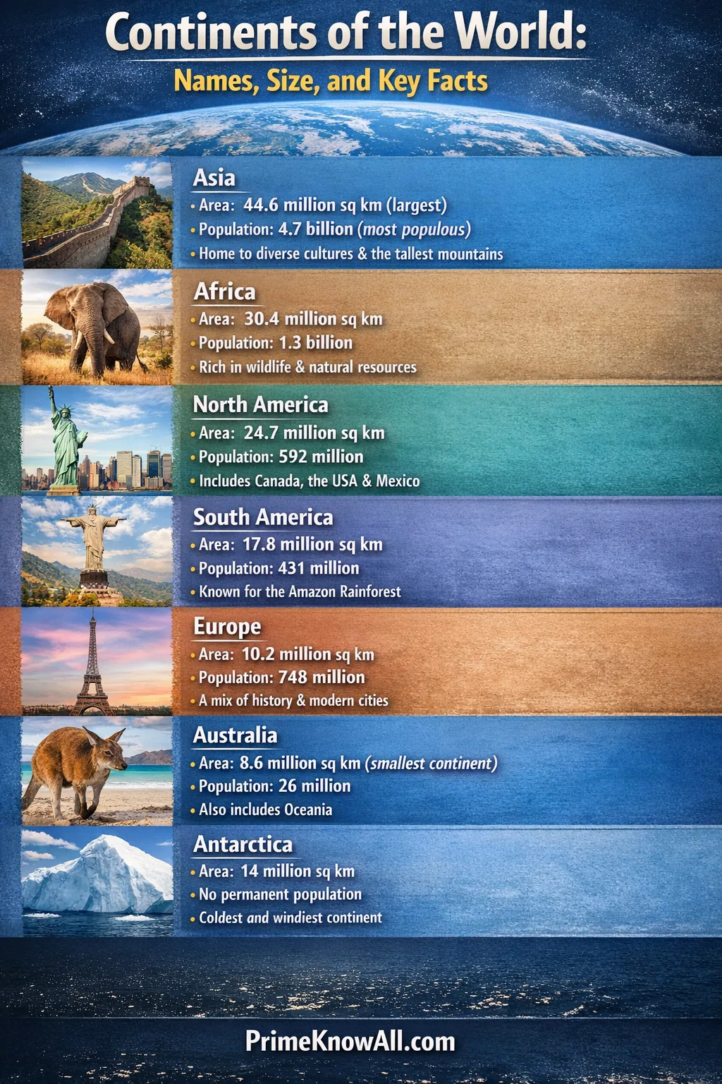
Asia
Asia is the largest continent by area and the most populous by a wide margin. Its landscapes span Arctic coastlines, towering Himalayan peaks, vast steppe, and some of the world’s biggest river basins.
In physical terms, Asia contains major tectonic collision zones where plates meet, which helps explain its extreme relief—from high plateaus to deep ocean trenches offshore. In human terms, it holds a dense mosaic of languages, religious traditions, and urban systems that range from ancient trade hubs to modern megacities.
- Signature landforms: Himalayas, Tibetan Plateau, Siberian plains, island arcs in the Pacific.
- Climate range: Polar cold to equatorial humidity, plus some of Earth’s largest deserts.
- Why it matters: A major center of biodiversity, manufacturing, and global trade routes.
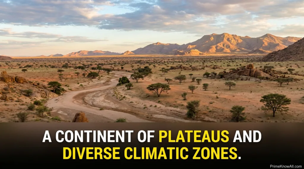
Africa
Africa is often called a continent of plateaus, with large interior highlands and long stretches of coastline. It straddles the equator, which gives it a powerful mix of climatic zones—from tropical rainforests to Mediterranean coasts.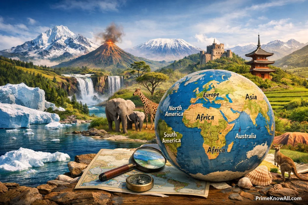
The continent is home to the Sahara, the world’s largest hot desert, and the Great Rift Valley, a region tied to deep tectonic processes where parts of the crust are slowly pulling apart. Africa’s ecosystems include globally important savannas, wetlands, coral coasts, and mountain habitats that support exceptional species diversity.
Africa’s geography is a reminder that continents can be shaped by both slow tectonic change and fast-moving climate patterns.
- Signature regions: Sahara, Congo Basin, Horn of Africa, Cape region.
- Major rivers: Nile, Congo, Niger—key to water, agriculture, and settlement.
- Why it matters: Strong cultural diversity, fast-growing cities, and some of the planet’s most iconic wildlife landscapes.
North America
North America stretches from the Arctic to the tropics, creating a wide band of climates and ecosystems. Two major mountain chains—the Rockies and the Appalachians—frame broad interior plains and major river systems.
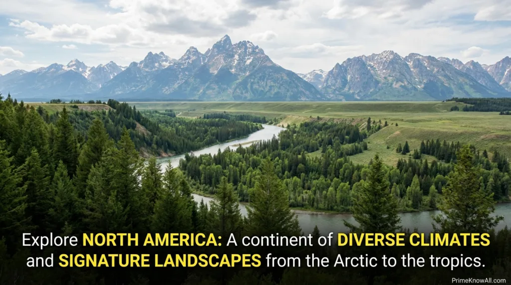
Its coasts touch three oceans, which shapes weather and ocean currents, and it includes large island systems such as Greenland and the Caribbean. The continent contains extensive freshwater resources, including the Great Lakes, and its landscapes show clear evidence of past glaciation in the north.
- Signature landforms: Rockies, Great Plains, Canadian Shield, deserts of the southwest.
- Climate range: Polar tundra, temperate forests, arid basins, humid subtropics.
- Why it matters: Major influence on global agriculture, technology, and research networks.
South America
South America is defined by dramatic contrasts: the Andes run like a spine along the west, while the east holds vast river basins and broad highlands. It contains the Amazon, one of Earth’s most important systems for biodiversity and carbon storage.
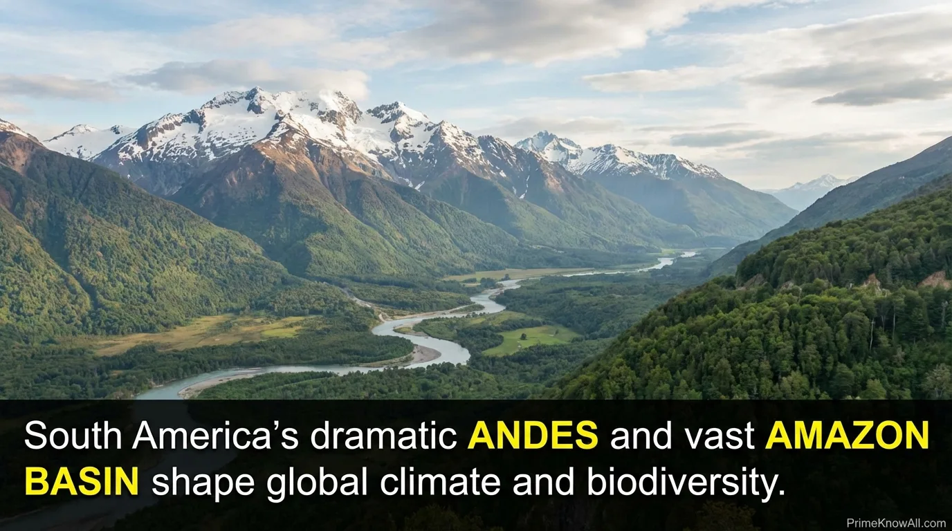
Because the Andes interact with atmospheric circulation, they help create strong rain shadow effects and shape regional climates. This is part of why South America includes both the humid Amazon and some of the world’s driest places, such as the Atacama region.
- Signature regions: Andes, Amazon Basin, Pampas, Patagonia.
- Ecological highlights: Tropical forests, high-altitude grasslands, coastal upwelling zones.
- Why it matters: A central player in global climate dynamics and freshwater cycles.
Antarctica
Antarctica is the most remote and most ice-covered continent. It has no permanent residents, yet it is one of the most scientifically valuable places on Earth because its ice stores long records of past atmosphere and climate.
The continent’s ice sheet holds an enormous share of the planet’s fresh water, and its surrounding Southern Ocean strongly influences global circulation. Even small changes in Antarctic ice dynamics can matter for sea level and long-term climate patterns, which is why research stations and international collaboration are so prominent there.
- Defining feature: A massive ice sheet with extreme cold and strong seasonal light changes.
- Living systems: Mostly coastal and marine—penguins, seals, and rich ocean food webs.
- Why it matters: Critical to understanding Earth’s climate history and ocean-driven heat transport.
Europe
Europe is relatively small by area, yet it is deeply influential in global history, science, and industry. Geographically, it forms the western peninsula of the larger Eurasian landmass, which is why its boundary with Asia is partly conventional.
Common boundary markers include the Ural Mountains, the Ural River, the Caspian Sea, the Caucasus, and the waterways connecting the Black Sea to the Mediterranean. Europe’s climate is shaped by the Atlantic and by ocean-driven heat transport, helping keep much of the continent milder than other regions at similar latitudes.
- Signature regions: Scandinavian Peninsula, Iberian Peninsula, Alps, Balkan Peninsula.
- Climate notes: Maritime influence in the west, continental extremes in the interior, Mediterranean patterns in the south.
- Why it matters: Dense networks of cities, universities, and cross-border infrastructure.
Australia And The Oceania Region
Australia is the smallest continent in the seven-continent model, but it anchors the broader region often called Oceania, which includes many Pacific islands. This is why the name you see depends on context: some references emphasize the continent (Australia), while others emphasize the region (Oceania).
Australia is famous for its unique ecosystems and high levels of endemic species, shaped by long geographic isolation. Beyond the mainland, the Pacific islands reflect complex geologic stories—volcanic arcs, coral atolls, and uplifted limestone—each tied to ocean and plate processes.
- Signature landscapes: Interior deserts, eucalyptus forests, Great Barrier Reef, alpine zones in the southeast.
- Regional note: Oceania commonly includes Melanesia, Micronesia, and Polynesia.
- Why it matters: A key area for marine biodiversity and ocean-focused climate systems.
Patterns That Connect All Continents
Even though each continent has its own identity, several big patterns connect them. Latitude affects solar energy and seasons, oceans moderate temperatures and steer storms, and mountains redirect winds and rainfall. These forces shape where forests thrive, where deserts form, and where agriculture becomes most productive.
Another shared theme is time. Continents look stable on human scales, but they are moving pieces of a much longer story. The same Earth processes that created ancient supercontinents also continue to reshape coastlines, build volcanoes, and lift mountain ranges—slowly, but with real and lasting results.
Sources
U.S. Geological Survey (USGS) – This Dynamic Earth: The Story of Plate Tectonics [Background on plate tectonics and how Earth’s surface is organized]
U.S. Geological Survey (USGS) – Historical Perspective (This Dynamic Earth) [Clear overview of Pangaea and long-term continental drift]
NASA Earthdata – Tectonics [How NASA data supports studying Earth’s crust and plate motion]
National Geographic Society – Continent [Accessible definition and the common seven-continent list]
Encyclopaedia Britannica – Continent [A concise reference description of continents and common conventions]
FAQ
How Many Continents Are There?
In many English-language contexts, the common answer is seven. Other systems count six (by combining Europe and Asia as Eurasia) or five (by combining larger landmasses). The “right” count depends on the definition being used.
Are Europe And Asia Really Separate Continents?
They are separate in the seven-continent model, but physically they form a single connected landmass. The boundary between Europe and Asia is mostly a historical convention that uses features like the Ural Mountains and surrounding seas as practical markers.
What Is The Smallest Continent?
In the seven-continent list, Australia is the smallest by land area. Some references use the term Oceania to describe a broader region of islands, but the continent itself is Australia in many atlases.
Does Antarctica Have Countries Or Cities?
Antarctica has no permanent cities and no traditional national borders in the way other continents do. It hosts seasonal research stations where scientists study ice, oceans, and climate in an environment that is uniquely valuable for Earth science.
Are Continents The Same As Tectonic Plates?
No. Continents sit on thick continental crust, while tectonic plates are large moving slabs of lithosphere that can include both continental and oceanic crust. A single plate can carry parts of multiple continents, and a continent can include more than one plate boundary zone.
